SMUL - Sächsisches Staatsministerium für Umwelt und Landwirtschaft 26.11.2013 Europa Kabinett stellt Weichen für Ziel 3-Programme Mittelaufteilung und Gebietskulisse für neue Förderperiode festgelegt Das sächsische Kabinett hat heute (26. November 2013) Eckpunkte für die Ausgestaltung der künftigen EU-Programme der grenzübergreifenden Zusammenarbeit in der Förderperiode 2014-2020 gesetzt. Dazu gehören die Aufteilung der EU-Mittel auf die beiden Ziel 3-Programme, die Fördergebietskulisse sowie Vorschläge zur inhaltlichen Ausgestaltung. „Ich freue mich, dass wir diese wichtigen Voraussetzungen für eine Fortführung der grenzübergreifenden Zusammenarbeit mit Polen und Tschechien heute geschaffen haben“, sagte Umweltminister Frank Kupfer. „Die Kooperation mit unseren Nachbarn ist eine langjährige Erfolgsgeschichte, die es fortzusetzen gilt. Allein in der aktuellen Förderperiode haben Akteure in den grenznahen Bereichen von Sachsen, Polen und Tschechien bei ca. 250 Projekten gemeinsam angepackt und die Grenzen zwischen den Ländern vergessen lassen.“ Unterstützt wird die grenzübergreifende Zusammenarbeit durch die Europäische Union. Der Freistaat Sachsen erhält für den Förderzeitraum 2014 bis 2020 Mittel aus dem Europäischen Fonds für regionale Entwicklung (EFRE) in Höhe von insgesamt 130 266 482 Euro, um die Ziel 3-Programme weiter fortzuführen. Davon stehen ca. 77 Prozent für das Programm mit der Tschechischen Republik und 23 Prozent für die Zusammenarbeit mit der Republik Polen zur Verfügung. Die künftige Fördergebietskulisse umfasst die unmittelbar an der Grenze zur Tschechischen Republik bzw. zur Republik Polen liegenden sächsischen Landkreise Vogtlandkreis, Erzgebirgskreis, Mittelsachsen, Sächsische Schweiz-Osterzgebirge, Bautzen und Görlitz. Für das grenzübergreifende Programm mit der Tschechischen Republik hat sich das Kabinett auf eine Erweiterung des Fördergebietes um die kreisfreien Städte Dresden und Chemnitz, den Landkreis Zwickau sowie um die thüringischen Landkreise Saale-Orla und Greiz verständigt. Der tschechische Teil des gemeinsamen Fördergebietes umfasst die Bezirke Karlsbad, Ústí nad Labem und Liberec. Zum künftigen Fördergebiet an der sächsisch-polnischen Grenze gehören neben dem Landkreis Görlitz der Landkreis Bautzen und auf polnischer Seite die Unterregion Jeleniogórski der Woiwodschaft Niederschlesien sowie der Landkreis Żarski der Woiwodschaft Lubuskie. Die inhaltliche Ausrichtung der Programme wird zwischen den beteiligten Partnerländern in je einer gemeinsamen Redaktionsgruppe abgestimmt. Dabei werden sowohl die sächsischen als auch die tschechischen bzw. polnischen Prioritäten sowie die vorherrschende sozio-ökonomische Situation berücksichtigt. Als mögliche Förderschwerpunkte zeichnen sich Maßnahmen zur Anpassung an den Klimawandel, zur Risikoprävention und Risikomanagement, für den Umweltschutz und die Ressourceneffizienz, Kunst und Kultur sowie Tourismus, Maßnahmen im Bereich der Verkehrsinfrastruktur, Investitionen in Bildung, Kompetenz und lebenslanges Lernen sowie Maßnahmen für die Verbesserung der Zusammenarbeit von staatlichen, kommunalen und regionalen Einrichtungen ab. Hintergrund: In der aktuellen Förderperiode sind über das Ziel 3-Programm Sachsen-Tschechien rund 207 Millionen Euro in mehr als 200 Projekte geflossen. Über das Ziel 3-Programm Sachsen-Polen wurden mit rund 100 Millionen Euro mehr als 130 Projekte finanziert. Die geförderten Projekte kommen aus den Bereichen Natur- und Umweltschutz, Bildung, Kultur, Wirtschaft, Tourismus und Verkehr, Polizei und Rettungswesen sowie Brand- und Katastrophenschutz. -- (c) by Medienservice Sachsen. http://www.medienservice.sachsen.de/
[ IMPRESSUM (c) 2003 - 2024 ]
The WEBLOG informs especially about Interoperability, Sustainability and Usability issues in connection with the implementation of Directives 2003/98/EC ( PSI = Public Sector Information re-use ) and 2007/2/EC ( INSPIRE = INfrastructure for SPatial InfoRmation in Europe ) across borders in EUROPE of REGIONS.
WEBLOG Contents have been updated last: 07.11.2023
WEBLOG News Readings are to be updated: daily
Copyright (c) 2003-2024 by [ FH ], All rights reserved !
+++
[ WEBLOG Reading... updated daily! ]
-
The Missing Layer Between Heritage Standards and Heritage Data - Cultural heritage has comprehensive standards for describing what things are. What has been harder to come by is how to effectively use them to let the dat...3 days ago
-
PLEASE READ THIS - So, during my career, I discovered OpenStreetMap. While editing, I used Google Maps and Street View, and I shouldn’t have read the guide, which is not al...4 days ago
-
Ledovce jsou pro přežití lidstva klíčové – jak jsme na tom ale se zajištěním vodních zdrojů a jejich ochranou u nás? - Organizace spojených národů vyhlásila hlavním mottem letošního Světového dne vody, který si připomínáme každoročně 22. března, „Glacier Preservation“, tedy...1 year ago
-
-
Bentley erwirbt Cesium - Bentley Systems, der Anbieter von Software für CAD und Infrastruktur-Engineering, hat die Übernahme des 3D-Geospatial-Unternehmens Cesium bekannt gegeben...1 year ago
-
Vitako: Neues Führungsduo - Die Bundes-Arbeitsgemeinschaft der Kommunalen IT-Dienstleister, Vitako, bekommt ein neues Führungsduo: Lars Hoppmann wird ab dem 1. Oktober als geschäftsfü...1 year ago
-
-
5th Living-in.eu plenary meeting - The 5th Living-in.eu plenary meeting with signatories took place on the 23rd of April and focused on How Local Digital Twins can contribute to the European...5 years ago
-
-
-
Germany's last MapDesignArtist - KARTOGRAPH DR. ROLF BÖHM Deutschlands letzter Landkartenmaler https://www.bild.de/regional/dresden/dresden-aktuell/kartograph-dr-rolf-boehm-deutschlands-l...7 years ago
************************************************************************
*************************************************
Sunday, 1 December 2013
EUROPA - Cross-border Support Programme 2014-2020
Wednesday, 25 July 2012
GDI-SN-News @ Facebook / Linkedin / Twitter: eGOV/DLR + CCC + DGF + DDGI
"... Vor allem der antiquierten Schriftform ist es geschuldet, dass fast alle Fachanwendungen in der Verwaltung nach wie vor gänzlich auf Papier angewiesen sind"...
11 minutes ago
Ign Vorstand Siehe auch:
eGovernment-Gesetz des Bundes: Bleibt das künftige eGovernment-Gesetz in den Ländern ohne Wirkung?
2) CCC -
Monday at 12:15 near Dresden
3) DGF
ZITAT: "... Die Parlamentarische Staatssekretärin im Bundesumweltministerium Ursula Heinen-Esser betonte in ihrer Eröffnungsrede Deutschland georeferenziert, dass der Bund in vielen die GI betreffenden Dingen vorangehe, wie z.B. der Öffnung der Daten im neuen Geodatenzugangsgesetz, und dass sie sich Gleiches von den Bundesländern wünsche. Dr. Georg Thiel aus dem Innenministerium setzte hinzu: „Staatliche Geodaten müssen so nutzerfreundlich verfügbar werden wie bei Google. /ZITAT/VDV.
--
Wann folgt ein GeoZG-Update auch in den 16 Bundesländern, demzufolge sollte sich die AdV dazu äußern, wenn überhaupt... !??
--
See as well our comments from an earlier weblog info:
[http://gdi-sn.blogspot.de/2012/07/geozg-geodatenzugangsgesetz-has-been.html]
ZITAT: "... The so-called GeoZG (2009) has been changed again by German 'Bundestag' at 28.06.2012 in order to allow further decisions to provide FEDERAL geodata not only for private, but also for commercial ( ! ) FREE-OF-CHARGE re-use...
But, it will be of interest IF and WHEN the federal decision will be confirmed and applied at regional (state) and local (communal) levels too" ? /ZITAT/ FH.
www.vdv-online.de
Monday at 11:50 near Dresden
4) VDV/DGFIgn Vorstand
Kommentar zum DDGI-Geo-Forum (via VDV-Online-Post):
=> "Statistische Daten brauchen Raumbezug!"
So neu ist diese "Erkenntnis" ja nun wirklich nicht, denn die statistischen Ergebnisse der VBWGZ'71 (Volks-, Berufs-, Wohnraum- und Gebäude-Zählung) mit automatisierter Auswertung auf Gitternetzbasis mittels elektronischer Lichtsatztechnik (LINOTRON-303) beim Kartographischen Dienst Potsdam wurden im sogenannten VBWGZ-ATLAS kartographiert ! / IGN e.V. [FH].
Siehe auch Zitat:
"... Der Zensus von 1950 in der DDR blieb aus politischen Grnden unver��ntlicht, die weiteren Zählungen fanden 1964 als Volks- und Berufszählung (VBZ) und 1971 und 1981 als Volks-, Berufs-, Wohnraum- und Gebäudezählung (VBWGZ) statt. Nach dem Beitritt der 1990 restituierten Länder der DDR zur Bundesrepublik Deutschland gab es wegen anderer Prioritäten zunächst keine Gelegenheit und verwaltungsseitig keine einheitliche Basis fr eine gesamtdeutsche Volkszählung..." [http://www.isru.de/text-01.pdf].
GI2012 - 12. Saxonian GIS-Forum
- PRESENTATIONS & PROCEEDINGS
- GI2012-OpenDataPolicies-FORUM
- ( Dresden: 18./19.05.2012 )
Tuesday, 3 July 2012
GeoZG (Geodatenzugangsgesetz) has been changed again by German ‚Bundestag‘
- The so-called GeoZG (2009) has been changed again by German 'Bundestag' at 28.06.2012 in order to allow further decisions to provide FEDERAL geodata not only for private, but also for commercial ( ! ) FREE-OF-CHARGE re-use...
- But, it will be of interest if and when the federal decision will be confirmed and applied at regional (state) and local (communal) levels too... /fh.
[ http://www.bundestag.de/dokumente/textarchiv/2012/39612147_kw26_angenommen_abgelehnt/index.html ]
IGN e.V. / fh.
1. Lesung im Bundestag !
[ 2012/05/18 - DE - Bundesregierung - AENDERUNGSANTRAG (GeoZG - 2009) ]
[ 2012/05/24 - DE - Bundestag - VIDEO (GeoDatenZugangsGesetz - 1. Lesung) ]
--
Bundestag: Entwicklung und Stand von Open-Data-Projekten
Experten im DBT-Unterausschuss "Neue Medien"
[ 2012/06/25 - DE - Bundestag - Entwicklung und Stand von Open-Data-Projekten ]
- Bundesregierung zu Open Data - Wir versuchen einen Kulturwandel
- Transparenz - Bundesregierung will Open Data, aber kein Gesetz
Bundestag: GeoZG in den Ausschüssen „Inneres + Verkehr + Umwelt“
2./3. Lesung im Bundestag !
[ 2012/06/26 - DRAFT of the GeoZG change at 'Bundestag' ]
[ 2012/06/28 - DECISION on changing the GeoZG (Geodatenzugangsgesetz) ]
National Land Survey of Finland, @SDI-Magazine, 02.03.2012
--
GI2012 - 12. Saxonian GIS-Forum
PRESENTATIONS & PROCEEDINGS
- GI2012-OpenDataPolicies-FORUM
- ( Dresden: 18./19.05.2012 )
- [ http://GDI-SN.blogspot.com ]
Wednesday, 20 June 2012
Aktuelle GDI-SN-Weblog-News: INSPIRE + DDGI +Geojobs
INSPIRE-Konferenz vs. DDGI-Geoforum !??
Während sich die GDI-Community Europas vom 23.06. bis 27.06.2012 in Istanbul (TR) zur diesjährigen INSPIRE-Konferenz trifft, um über den Status der Implementierung sowie zur Strategie und die weiteren Aufgaben zur INSPIRE-Umsetzung der Annex II und III unter den Bedingungen der aktuellen Finanzkrise zu beraten, plant parallel dazu der DDGI am 25./26.06.2012 sein so genanntes 5. "Deutsches Geoforum" ...
- DDGI veranstaltet mit dem RatSWD das 5. Deutsche Geoforum [ http://www.ddgi.de/index.php?opt ] 5:06 PM - 19 Jun 12 via web
- Sozial- u.Wirtschaftdaten (Auswertung statist.Daten) Wertschöpfung mit Geodaten: 5. DGF Ende Juni in Berlin http://www.ddgi.de !Programm! 5:03 PM - 19 Jun 12 via web
- Interessantes
#Event in#Berlin: 5. Deutsches Geoforum: Geoinformation und Sozial- u.Wirtschaftsdaten - http://xing.com/r/Zbh2P Das volls... 11:45 AM - 5 May 12 via XING - Interessantes
#Event in#Berlin: 5. Deutsches Geoforum: Geoinformation und Sozial- u.Wirtschaftsdaten - http://xing.com/r/Zbh2P 4:15 PM - 20 Apr 12 via XING - Interessantes
#Event in#Berlin: 5. Deutsches Geoforum: Geoinformation und Sozial- u.Wirtschaftsdaten - http://xing.com/r/Zbh2P Save the ... 8:16 PM - 26 Mar 12 via XING
Wer mehr wissen möchte, zu welchen Ergebnissen der RatSWD bezüglich Zugang zu und Nachnutzung von Geodaten und thematisch-statistischen Daten gekommen ist, der kann sich bereits mit dem RatSWD-Report vom 12. Dezember 2011
Insoweit bleibt abzuwarten, zu welchem Ergebnis der Deutsche Bundestag in zweiter Lesung des Änderungsantrages der Bundesregierung (siehe Verweise unten) betreffs Änderung des erst 2009 erlassenen so genannten GeoZG (Geodaten-Zugangs-Gesetz) gelangt, um künftig die Geodaten des Bundes sowohl für die private, als auch kommerzielle ( ! ) kostenlose Nachnutzung zu öffnen...
2)
Neue Stellenangebote und Stellengesuche auf www.GEOjobs.de
- Die Bundesanstalt für Geowissenschaften und Rohstoffe, Hannover sucht ab 01. 07. 2012 einen Geowissenschaftler Ingenieurwissenschaftler (m/w)
- Die Bundesanstalt für Geowissenschaften und Rohstoffe, Hannover sucht ab 01. 06. 2012 einen Projektmitarbeiter (Geologie, Geographie) m/w
- Die Bundesanstalt für Immobilienaufgaben, Bonn sucht ab 15. 06. 2012 einen Sachbearbeiter Geodatenmanagement (m/w)
- Die Niedersächsische Landesbehörde für Strassenbau und Verkehr, Bad Gandersheim sucht ab 15. 06. 2012 einen Vermessungsingenieur (m/w)
- Die Stadt Pforzheim sucht ab 01. 07. 2012 einen GIS-Ingenieur (m/w)
- Die geomer GmbH, Heidelberg sucht ab 01. 07. 2012 einen Mitarbeiter im Bereich Vertrieb/Marketing (m/w)
- Die Stadtwerke Magdeburg suchen ab 01. 09. 2012 einen Trainee GIS-Anwendungen (m/w)
- Die Firma IP SYSCON GmbH, Hannover sucht ab 01. 07. 2012 einen ArcGIS Desktop Entwickler (m/w)
--
GI2012-OpenDataPolicies-PRESENTATIONS - ONLINE !
GI2012-OpenDataPolicies-FORUM / Dresden: 18./19.05.2012
[ 2012/05/18 - DE - Bundesregierung - ÄNDERUNGSANTRAG (GeoZG - 2009) ]
[ 2012/05/24 - DE - Bundestag - VIDEO (GeoDatenZugangsGesetz - 1. Lesung) ]
--
IGN-Vorstand-Kontakte:
[ skype: fh-ign ]
[ mailto:info@GDI-SN.de ]
Wednesday, 23 May 2012
Deutscher Bundestag berät Antrag für ein Gesetz zur Änderung des so genannten „Geodaten-Zugangsgesetzes“
- Diese Ankündigung ist zugleich eine Bestägung ausgewählter Beiträge zum "12. Sächsischen GIS-Forum" am 18./19. Mai 2012 in Dresden - dem GI2012-OpenDataPolicies-FORUM, die bereits Eingang in die internationale Diskussion der LINKEDIN bzw. INSPIRE Interest Groups gefunden haben!
- [http://www.linkedin.com/groupAnswers?viewQuestionAndAnswers=&discussionID=117055837&gid=116497&commentID=81825295&goback=.gde_116497_member_117055837&trk=NUS_DIG_DISC_Q-ucg_mr#commentID_81825295 ]
- [http://www.linkedin.com/groupAnswers?viewQuestionAndAnswers=&discussionID=117790401&gid=1066897&commentID=-1&trk=view_disc&ut=3TyX4m-qJQe5g1 ]
Das Beispiel der Landesvermessung Finnlands - dies hatten wir bereits im Januar 2012 berichtet - dürfte mit dieser Gesetzes-Änderungs-Initiative der Bundesregierung auch die amtliche, kommerzielle und private Geoinformationswirtschaft nicht nur auf Bundesebene, sondern auch in den Bundesländern "beflügeln", d.h. ohne erneut 16 länderspezifische Gesetze zur Änderung ihrer Geodatenzugangsgesetze ohne weiteren Zeitverlust zu beraten...
Allerdings bleibt abzuwarten, in welcher Form die geplante Verordnung zur Umsetzung der Gesetzesänderungen auf Bundesebene ausgestaltet wird, um diese Regelungen in die Landesverordnungen zeitnah zu übernehmen.
IGN e.V. / fh / 21:50
[ GDI-SN-Weblog - ClustrMapsAccess ]
[ GI2015 - 15. Sächsisches GI/GIS/GDI-Forum PROCEEDINGS & PRESENTATIONS ]
- GI2015 - PROCEEDINGS & WEB Resources (3 MB)
- GI2015 - HOFFMANN - IGN: Introduction (9 MB)
- GI2015 - CHARVAT - COO: ICT for Agriculture (1 MB)
- GI2015 - MAYER - COO: Agriculture status (12 MB)
- GI2015 - KARAS - UPVISION: UAS Technology (10 MB)
- GI2015 - HLADIKOVA - CENIA: Copernicus (2,5 MB)
- GI2015 - FIORE - EURISY: GI+LBS Data (106 MB !)
[ GI2014 - 14. Sächsisches GIS-Forum - PROCEEDINGS & PRESENTATIONS ]
- GI2014 - PROCEEDINGS & PROGRAMME (PDF, 8 MB)
- GI2014 - CHARVAT & Mayer - The EU Project FOODIE
- GI2014 - CHARVAT & Mildorf - EU Projects Plan4all & Plan4business - The Future of European Planning Data
- GI2014 - FAUGNEROVA - INSPIRE Business&Strategy
- GI2014 - FRYML & Team - Czesko Jede Portal
- GI2014 - FURDIK & MECIAR - Danube Brownfields
- GI2014 - FURDIK.J & Team - Danube Riverbanks
- GI2014 - HOFFMANN - Open GDM Forum Introduction
- GI2014 - KOZUCH - PLAN4all: Map Composition
- GI2014 - MAYER - The Club of Oissach
- GI2014 - SCHILLER - Integrierte Daten - BIM
- GI2014 - SREDL & Team - The LAYMAN Tool
- GI2014 - VOHNOUT & Team - EU Project ERRA
- GI2014 - ZSCHEILE - Lizensierung OpenData
[ ODM Links => 14. Sächsisches GIS-Forum ]
- 15.12.2013 - GI2014 Forum (Intern Concept Paper)
- 25.11.2013 - Workshop on PSI Re-Use Directive (2013/37/EU)
- 15.11.2013 - CHRISTL Three Decades of Openness in Geospatial
- 26.06.2013 - New PSI Re-Use Directive (2013/37/EU)
- 18.06.2013 - G8 OpenDataCharter
- 09.05.2013 - US Executive Order on OpenDataPolicy
- 07.02.2013 - Open Letter of German OpenDataCommunity
- 18.05.2012 - GI2012 OpenDataPolicies Proceedings
- 30.09.2010 - New UK Open Government Licence
- 17.11.2003 - PSI Re-Use Directive (2003/98/EC)
[ GI2013 ] - DRESDEN - 13. "Sächsisches GI/GIS/GDI-Forum" - SAXONY
[ GI2013 - FORUM - PROCEEDINGS & PRESENTATIONS ]
- GI2013 - GI/GIS/GDI - PROCEEDINGS
- GI2013 - ANDREOPOULOS & KAZAKIS - SustainableFuture
- GI2013 - BEHR - UNOrg+GeoData
- GI2013 - BUONO - SeismicGeoSDI
- GI2013 - CHARVAT & Team - AgriXchange
- GI2013 - CHARVAT & Team - Apps4Europe
- GI2013 - DECEWICZ - SpatialPlanning
- GI2013 - FURDIK & Team - SustainabilityAnalysis
- GI2013 - FURDIK & Team - SunlightRays
- GI2013 - HERLITZIUS & GRIMSEL - AgroSystemTechnik
- GI2013 - HOFFMANN - Welcome+Introduction
- GI2013 - HOFFMANN - XborderGDI+Sustainability
- GI2013 - ILIEV & NIKOLOVA - AerospaceTTO
- GI2013 - JANECKA & Team - Terezin3D
- GI2013 - KAFKA & Team - INSPIREinPocket
- GI2013 - LÖWNER - Geodata+Transportation
- GI2013 - MAYER - Agri+Forestry
- GI2013 - MILDORF & Team - Plan4Business
- GI2013 - MILDORF & Team - ERRA
- GI2013 - PÄTZUG & RAUSCHERT - Logistics
- GI2013 - SCHAAFSMA & SCHAAIK - Criminality
- GI2013 - VOHNOUT & Team - EnviroGRIDS
[ GI2013 - FORUM - DRESDEN: 29./30. April ]
- [ GI2013 ] - Presentations @ SLIDESHARE
- IGN-Vorstand @ "Powered by INSPIRE" KONFERENZ (Brussel, 4./5.March 2013)
- 4th European Civil Protection Forum - Brussels, 15-16 May 2013
- Spatial and Social Aspects of Disaster Management 22-23 May 2013 in Budapest
- [ 2013 ] - BBK: LÜKEX (Länder übergreifendes Krisenmanagement)
- [ GI2012 ] - OpenDataPolicies - PROCEEDINGS (PDF/9.5MB)
- [ GI2012 ] - ODP-Presentations-INTRO (PPT/6.9MB)
- [ 2011 ] - VIDEO on the GMES/COPERNICUS Emergency Management SERVICE ]
[ 2013 ] - The Year of European Citizens !!!
- 2013 - The YEAR OF EUROPEAN CITIZENS !!!
- 2013 = 13 YEARS "Sächsisches GI/GIS/GDI-FORUM" ! ( DRESDEN: 29./30.04.2013 )
- ISDE 2013 ( Malaysia: 26.-29.08.2013 )
- ICC2013-CARTO-Congress # Virtual Flight over (Dresden: 22.08.-01.09.2013 )
- eGOV-Kongress ( Leipzig: 04.-05.06.2013 )
- REAL CORP 2013 ( Rome: 20.-22.05.2013 )
- Open-GOV-Data ( Berlin: 16.05.2013 )
- AGILE-Conference ( Leuven: 14.-17.05.2013 )
- Geospatial World Forum ( Rotterdam: 13.-16.05.2013 )
- EUROGEO-Conference ( Bruges: 08.-11.05.2013 )
- ISCRAM 2013 ( Baden-Baden: 12.-15.05.2013 )
- GEO-Forum-MV (HRO-Warnemünde: 15./16.04.2013)
- EUROGI-Conference ( Dublin: 07.-08.03.2013 )
- ePSIplatform Conference 2013 (Warszawa:22.02.2013)
- GISOVA2013 ( TU-Ostrava: 21.-23.01.2013 )
[ ICA # ACI ] - ICC2013 - Dresden/Saxony, 25.-30.08.2013
[ Aktualisierung Geodaten-Zugangs-Gesetz ]
- 2012/08/01 - STUDIE "Open Government Data Deutschland" (see posting below!)
- 2012/07/02 - ENTSCHEIDUNG zum GeoZG im Bundestag (c) Info by VDV-Online
- 2012/06/29 - DECISION on GeoZG change in German 'Bundestag'
- 2012/06/26 - DISCUSSION of GeoZG change in 'Bundestag'
- 2012/05/18 - PROPOSAL for GeoZG change in 'Bundestag'
*** DRESDEN - Saxony - GERMANY ***
12. Sächsisches GIS-Forum - GI2012-OpenDataPolicies (DRESDEN:18./19.05.2012)
*****************************************************************************************
!!! [ GI2012-OpenDataPolicies-PROCEEDINGS ] !!!
!!! ( PRESENTATIONS of the GI2012-OpenData-Policies-FORUM - see below) !!!
*****************************************************************************************
[ GI2012 - OpenDataPolicies - Presentations ]
- GI2012 - Keynote: HOFFMANN, Vorstand-IGN (Introduction to PSI + OpenDataPolicies)
- GI2012 - Keynote: CHRISTL, President-OSGeo (INSPIRE+Mythos+Reality)
- GI2012 - Keynote: MAYER, CEO-PROGIS-AT (WinGIS+30cmOrthoIMAGES) *not public !*
- GI2012 - Keynote: TRAKAS, Director OGC/EUS (OGC+Standards+Process)
- GI2012 - BARTOLI (SnowAvalancheSDI+Annex3)
- GI2012 - BARTOLI (Introduction to OpenGeoSuite)
- GI2012 - BUONO (CNR+geoSDI+Platform)
- GI2012 - CAJTHAML (CadastralDataQuality)
- GI2012 - CHARVAT (OpenAccess to AgriData)
- GI2012 - CHRISTL (OSGeo+FOSS+OSM+ODbL)
- GI2012 - FAUGNEROVA+Team (INSPIRE+Geoportal2.0)
- GI2012 - HOFFMANN (Data-Needs+NGIS?)
- GI2012 - HOFFMANN (OpenData vs. DataProtection)
- GI2012 - PÄTZUG (OpenData+Logistics)
- GI2012 - PATERNO (OpenData+OpenSociety)
- GI2012 - PEKAREK+HOFFMANN (INMAP+Poster)
- GI2012 - PEKAREK (LIBER+Europeana+EUNPP)
- GI2012 - POPIOLEK (Breitbandatlas-DE+EU)
- GI2012 - SREDL+Team (INSPIRE+Implementation+OWS)
[ Public Sector Information (PSI) ]
- ACCESS the ePSIplus Network’s NEWS
- 2012/06/25 - GeoZG - Bundestag (Die Bedeutung von Open-Data für die Zukunft)
- 2012/06/19 - W3C - Report (Workshop on Open Data)
- 2012/06/01 - US - eGOV-Strategy (Barack Obama Directs All Federal Agencies to Have an API)
- 2012/06/01 - NO - The Norwegian Open Data Handbook
- 2012/05/30 - DE - BODDy (Berlin OpenData Day)
- 2012/05/29 - EC - PEER - Open Access - a reality for Science (N. KROES - VicePresident of the EC for DigitalAgenda2020)
- 2012/05/27 - eGOV - Streit um die Geodaten des Bundes (Geodaten für alle kostenlos – „Big Brother“ oder Transparenz?)
- 2012/05/25 - DE - Bundestag - DISKUSSION (GeoDatenZugangsGesetz - Änderungsantrag)
- 2012/05/24 - DE - Bundestag - VIDEO (GeoDatenZugangsGesetz - 1. Lesung)
- 2012/05/19 - GI2012 - A. CHRISTL, OSGeo: INSPIRE - Mythos & Reality, (KEYNOTE @ 12. Sächsisches GIS-Forum, DRESDEN: 18./19.05.2012, PROCEEDINGS: pp. 30-33)
- 2012/05/18 - DE - Bundesregierung - ÄNDERUNGSANTRAG (GeoDatenZugangsGesetz-ENTWURF)
- 2012/05/18 - GI2012 - F. HOFFMANN & K.CHARVAT: GeoINSPIRE'd X-border-OpenDataPolicies for Digital Europe 2020 (12. Sächsisches GIS-Forum, DRESDEN: 18./19.05.2012, PROCEEDINGS: pp. 11-14)
- 2012/05/15 The DIGITAL AGENDA in the Light of Geoinformation (N. KROES - VicePresident of the EC for DigitalAgenda2020)
- 2012/03/16 - PSI - Conference (The ePSIplatform PANEL discussion on the revised PSI Directive - 57 min VIDEO)
- 2012/03/16 - PSI - Conference PROCEEDINGS & Presentations (The ePSIplatform Conference 2012 took place on 16 March 2012, in Rotterdam)
- 2012/03/02 - DE - Bundestag - BGeoRG (BundesGeoReferenzdatenGesetz)
- 2012/02/26 - eGOV - WKBlog (E-GOV in der Trutzburg: das Rheingold?)
- 2011/12/13 - EU - OpenAccess to Public DATA
- 2011/12/12 - PSI - Open Data Strategy
- 2011/12/12 - EC - OpenDATA - COM(2011)882
- 2011/12/07 - EU - Datenschutzverordnung (REDING: Gegen den unkontrollierten Datenstrom)
- 2011/10/06 - EC - Kohäsionspolitik der Zukunft (2014-2020)
- 2011/09/23 - DE - BGeoRG - NEWSTICKER (Bundesrat gegen Bundesgeoreferenzdatengesetz)
- 2011/09/23 - DE - Bundesrat - ABLEHNUNG (BundesGeoReferenzDatenGesetz)
- 2011/08/30 - eGOV - Standards für Europa (Verloren im Zuständigkeitsgerangel zwischen Brüssel und Berlin)
- 2011/06/18 - DE - Bundesregierung - BGeoRDG (BundesGeoReferenzDatenGesetz)
- 2011/04/27 - US - eGOV - Executive Order 13571
- 2011/03/04 - eGOV - Geoinformation à la BMI (Das verstreute Wissen der Gesellschaft nutzen)
- 2011/01/11 - eGOV - Regierungsprogramm „Vernetzte und transparente Verwaltung“
- 2010/09/20 - DE - "GeoDatenGipfel" (Innenminister setzt bei Geodaten zunächst auf Selbstregulierung)
- 2010/08/18 - DE - Bundesregierung (Regierungsprogramm "Vernetzte und transparente Verwaltung")
- 2010/05/14 - UK - Chris CORBIN: Public Sector Information (PSI-Directive - One year on - Has Europe delivered?)
- 2009/02/14 - GeoZG - Kommentar (GeodatenZugangsGesetz tritt in Kraft)
- 2008/11/13 - DE - Bundestag - GeoZG (GeodatenZugangsGesetz)
- 2007/03/14 - INSPIRE - Directive 2007/2/EC (Infrastructure for Spatial Information in the European Community)
- 2006/08/25 - DE - Bundestag - PSI ("InformationsWeiterverwendungsGesetz"-ENTWURF)
- 2003/11/17 - PSI - Directive 2003/98/EC (PublicSectorInformation)
- PSI - News
- PSI - OpenDataPortal
- PSI - Data Visualization TOOLS
- PSI - Digital Agenda on OpenGOV Data "Gold"
- PSI - European Open Data Strategy Announced !
- PSI - Themes (European Public Sector Information Platform)
- PSI - Digital Agenda for Europe 2010-2020
- GI2008 - PSI - QUESTIONNAIRE
- PSI-Q results from GEO-Forum-LEIPZIG
- PSI-Q results from DDGI-Ausbildung POTSDAM
- PSI-Q results from GI2008-Symposium-DRESDEN
[ Top-News (c) HeiseOnline ]
[ GeoSDI - Lectures © by CNR, 2011-2012 ]
- GEOPORTAL Lectures (c) by D.D. BUONO - CNR (Protezione Civile Nazionale - Ver 1.4 Build 1708 - powered by CNR)
- [ INFO ]
- [ GEOPORTAL ]
- 00. Creating a geoportal account
- 01. Using base maps
- 02. Creating folders to connect WMS data
- 03. Selecting WMS server & layers
- 04. Changing WMS layer properties
- 05. Looking for address
- 06. Defining an area of interest
- 07. Looking for areas of interest
- 08. Creating a scenario
- 09. Modifying geographic elements
- 10. Calculating routes
[ NATURNET_Application+Portal_VIDEOS ]
[ GDI-SN-ARCHIV - Sächsisches GIS-Forum @IGN e.V. ]
- 12. Sächsisches GIS-Forum - GI2012 (PROCEEDINGS of the 12th GIS-Forum on Open Data Policies) +++ Presentations at [http://de.slideshare.net/IGN_Vorstand/presentations] + [http://de.slideshare.net/IGN_Vorstand/gi2012-hoffmannaddress-intro]
- 11. Sächsisches GIS-Forum - GI2011 (PROCEEDINGS of the eleventh cross-border Spatial and GeoData Infrastructure Symposium in Saxony/Germany) - [http://slidesha.re/mLsGEN]
- 10. Sächsisches GIS-Forum - GI2010 (The GI2010 cross border symposium 2010 – Sustainability of Inter-Regional Collaboration was held at the Technical University DRESDEN – ZINT – AgroCampus on the 14th and 15th May 2010. )
- 9. Sächsisches GIS-Forum - GI2009 (Programme, Abstracts, Posters, Press releases, GI documents and Resource links, Summaries)
- 8. Sächsisches GIS-Forum - GI2008 (Program & Proceedings of Abstracts, Summaries, Posters and other PSI, INSPIRE & GDI-DE Document Links)
- 7. Sächsisches GIS-Forum - NaturNet-GI2007 (NationalParkZentrum, 5.10.2007 - Bad Schandau - NATURNET-Dissemination-Programm.pdf)
- X-border-GI2007-Symposium-PRESENTATIONS - DRESDEN (by Chris CORBIN, UK): The X-border-GI2007-Symposium that was held in Dresden on the 10th & 11th May 2007 has published the papers and presentations. The presentations demonstrate the issues that arise when providing applications that serve cross-border regions. The Czech Statistical Office presentation is a good case study on how a Czech Public Sector Information Holder has responded to the implementation of the PSI Directive 2003/98/EC. The presentations also highlight the role of the private sector, academia as well as the public sector in cross border regions such as that in the Czech Republic, German, and Polish border region.
- [ X-GI2007-Final-Programm ] - Last Update: 08.05.2007
- 6. Sächsisches GIS-Forum, Dresden: 10./11. Mai 2007 (X_border_GI2007_Pre_INFO.pdf with further information about accomodation, social program etc.)
- 5. Sächsisches GIS-Forum - GI2006 (X-border-GDI)
- 4. Sächsisches GIS-Forum - GI2005 (X-INTERREG)
- 3. Sächsisches GIS-Forum - GI2004 (X-Emergency)
- 2. Sächsisches GIS-Forum - GI2003 (Comtec2003)
- 1. Sächsisches GIS-Forum - GI2002 (Comtec2002)
[ Location of IGN e.V. @ GoogleMAP ]
IGN e.V. auf einer größeren Karte anzeigen
[ GI2015 ] +++ 15. "Sächsisches GI/GIS/GDI-Forum" in DRESDEN +++
"15. Saxon GI/GIS/SDI Forum" - GI2015 - Workshop (c) by IGN e.V.
"Open GeoData Management for Agriculture & Forestry"
Dresden, 15. September 2015
[ http://GDI-SN.blogspot.com ]
Contact: [ info@GDI-SN.de ]
ARCHIV: [ GI2014-PROGRAMME+PROCEEDINGS ] PDF, 7 MB
*******************************************************************************************
15.09.2015 - CoO & GI2015 - Workshops on Open GeoData Management
UAV Technologies and Open Data for Precision Farming & Precision Forestry issues
COPERNICUS Program and SENTINEL Technologies for Agriculture and Forestry
INNOVATION and Technology transfer for International cross-border cooperation
MAPPING Technologies for Land use, Land cover and Rural Development
OPEN GEODATA Management for Environmental and Emergency
[ GI2015 - PROCEEDINGS - PDF, 3 MB ]
*******************************************************************************************
[ G-MAP ]
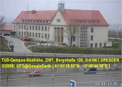
GPS [ 51°01’15.52″N ; 13°43’44.78″E ]
ISAF2015 @ TU-Dresden-AgriCAMPUS (ZINT)
Hotel Empfehlungen / Hotel recommendations / Pекомендации отеля
[ Booking.com Dresden ]
[ Hotels Dresden ]
[ ISAF2015 ] +++ 19. International Conference in DRESDEN +++
[ ISAF2015 ]
"19. International Conference ISAF2015" (c) organized by CCSS, Praha (CZ)
[ INFORMATION SYSTEMS for AGRICULTURE & FORESTRY ]
DRESDEN, 14. September - 15. September 2015
[ http://www.ClubOfOssiach.com/coo/visionandmission.html ]
Archive: [ http://ISAF2014.info/ ]
Contact: [ info@ISAF2015.info ]
[ ISAF2015 ] +++ 19. International Conference in DRESDEN +++
[ ISAF2015 ] +++ 19. International Conference in DRESDEN +++
[ GI2011-X-border-SDI/GDI-Symposium ]
* 23.5.2011 Bad Schandau (SAX) # 24.5.2011 Decin (CZE)
****************************************************
EUROPE OF REGIONS -
"GeoINSPIRE’d X-border-SDI/GDI for Digital Europe 2020"
Sustainability of Inter-regional Collaboration
****************************************************
* FINAL GI2011-X-Border-SDI/GDI PUBLICATIONS !
* [ PROCEEDINGS of GI2011-X-border-SDI ]
*** !!! PRESENTATIONS of GI2011-X-border-SDI
*** !!! stored on SLIDESHARE & are accessible via
*** !!! Social Networks instead of traditional GI20xx
*** !!! presentations of last years on ePSIplatform ...
* [ FACEBOOK | LINKEDIN | TWITTER ]
* [ ESDIN ] video-webcast (c) by A. CHRISTL, OSGeo (DE)
* [ PLAN4ALL ] snap-shot of T. MILDORF, UniWB (CZ)
* [ PLAN4ALL ] video-clip taken by (c) R.J. LACH (PL)
*** !!! inter-linked GI2011 presentations:
GI2011+proceedings v5 final
AEBR Ramirez ppt_gi2011
Charvat+Vohnout ppt gi2011 enviro
GI2011 poster sk stuba border
GI2011 poster sk stuba danube
Lach ppt gi2011
Mirbach+Lang ppt gi2011
Roehnert+Team ppt gi2011
Schrenk+Team ppt gi2011
Stern ppt gi2011
Thevenet ppt gi2011
Vohnout ppt gi2011 geoportal4everybody
****************************************************
GI2011-X-border-SDI/GDI-Symposium with inter-regional participation from European Border Regions (EBR) !
11. Sächsisches GIS-Forum, Bad Schandau (SAX), 23.05.2011
& 1. Bohemia # Saxonia GIS-Forum, Decin (CZE), 24.05.2011
+++ 33 Presentations had been selected from:
+++ AT, CZ, DE, ES, FR, IT, LV, OSGeo, PL, SK, ... !
****************************************************
All logistic, social, cultural and touristic weblinks have been re-located into weblog message of today, 28.5.2011, and stored into IGN's weblog postings ARCHIVE !
****************************************************
[ GI2010 - 10. Sächsisches GIS-Forum ]
The PRESENTATIONS of the Anniversary
10th International "Sächsisches GIS-Forum"
[ GI2010-Symposium-Poster-DRESDEN ]
"Sustainability of X-border & Inter-regional Collaboration"
[ GI2010_Proceedings_FINAL_WEB-Version ]
have been published @ European PSI platform !
+ [ HERLITZIUS - Welcome@AST ] DE-TU-Dresden
************************************************
KEYNOTE speakers:
+ [ HOFFMANN ] DE-Dresden-IGN e.V.
+ [ CORBIN ] UK-Brighton-ePSIplatform
+ [ BELOF ] PL-Wroclaw-WBU
+ [ CHARVAT ] CZ-Praha-CCSS
+ [ LONGHORN ] BE-Brussel-IDRA-Ltd.
+ [ MAYER ] AT-Villach-PROGIS-GmbH
************************************************
13. Mai 2010 / GI2010-Pre-Symposium-Authors-Meeting
------
14. Mai 2010 / 08:30 - 18:30 / GI2010-SYMPOSIUM
Sessions: GI2010, INNOVATIONS, X-border-GDI, NETWORKS
+ [ Mayer-Leixner ] NTR-Software GmbH, Heidesheim
+ [ BLACHOWSLI et al. ] PL-Wroclaw-WBU
+ [ VOHNOUT ] CZ-Praha-CCSS
+ [ FENCIK ] SK-Bratislava-SAGI&STUBA
+ [ BAUMANN-1 ] BayernGIS GmbH, Kolbermoor GmbH
+ [ MECHA et al. ] PL-Katowice-GISPOL/GEOBID GmbH
+ [ MILDORF et al. ] CZ-Plzen-WBUNI
+ [ JANECKA et al. ] CZ-Plzen-WBUNI
+ [ KUBICEK et al. ] CZ-Brno-MUNI
+ [ BERZINS ] LV-Riga-UNI
+ [ STARK ] CH-Muttenz-FHNW (TELE-Lecture)
+ [ LINGNER ] OSM-Consultant-Potsdam
+ [ KOSKOVA et al. ] CZ-Liberec-KULK
+ [ SCHAFFERT ] IKGIS/TUDA, Darmstadt
+ [ MODRY ] CZ-Liberec-KULK
+ [ KLOSA et al. ] OSM-Dresden
+ [ BAUMANN-2 ] BayernGIS GmbH, Kolbermoor
+ [ POPIOLEK ] LiveMap GmbH, Berlin
+ [ KLIMENT ] SK-Bratislava-STUBA (TELE-Lecture)
Workshops: Introductions / Kurzeinführungen
+ [ BAUMANN-WS ] BayernGIS GmbH, Kolbermoor
CAIGOS-Partner-NETZWERK:
++ [ MAYER-LEIXNER ] NTR-Software GmbH, Heidesheim
+++ [ NACHTIGALL ] ARCHIKART-Software AG, Lauchhammer
++++ [ LEHRACH ] GIS-Konzept, Leipzig & CAIGOS GmbH, Kirkl
------
15. Mai 2010 / 08:30 - 11:30 / GI2010-Post-Workshops
WS 1 - INSPIRE "Readiness-Check-List"
Vorbereitungstest für Kommunen & Landkreise
+ [ LONGHORN-1.1 ] - BE - Brussel, IDRA Ltd.
++ [ LONGHORN-1.2 ]
+++ [ LONGHORN-1.3 ]
------
WS 2 Kommunal & Regional GIS/GDI
Strategien für Kommunen & Landkreise
+ [ BAUMANN ] - BayernGIS GmbH, Kolbermoor
& CAIGOS-Partner-NETZWERK:
++ [ MAYER-LEIXNER ] - NTR-Software GmbH, Heidesheim
+++ [ NACHTIGALL ] - Archikart Software AG, Lauchhammer
++++ [ LEHRACH ] - GIS-Konzept GmbH, Leipzig
------
WS3 Agrarbetrieb der Zukunft - Farm of the Future -
The Vision for Tomorrow
+ [ CHARVAT ] - CZ - Praha, CCSS NGO
++ [ MAYER ] - AT - Villach, PROGIS GmbH
************************************************
POSTER-Exhibition by STUBA (SK)
+ [ Selected MobEx Posters.jpg ]
MobEX project lead by Dr. J. FURDIK,
Slovak Technical University Bratislava (FA-CADLAB),
has been funded by International Visegrad Fund
+ [ MobEX-Gallery-PROJECT ]
+ [ SK01 ] + [ SK02 ] + [ SK03 ]
+ [ CZ04 ] + [ CZ07 ]
+ [ HU04 ] + [ HU08 ]
+ [ PL01 ] + [ PL02 ]
For Poster abstracts see PROCEEDINGS !
************************************************
************************************************
[ GI2009 - 9. Sächsisches GIS-Forum ]
with international participation from
AT, BE, CN, CZ, DE.bb.nrw.sn, HU, PL, ... SK, UK
Status as per: 09.05.2009 !
-------
[ GI2009 - FINALPROGRAMM ]
WEBLOG-Version-20090515, ca. 250 KB
-------------------------------------------------------------------------------
Supporting organizations: "1spatial", "BusinessGeomatics", BOWGIS @FAA, CAGI, CCSS, ESPON @EC-Unit-Luxembourg, "interface:projects" GmbH Dresden, "PROGIS" Software GmbH Villach (AT), RegioGOV-LDD, RegioGOV-KULK (CZ), "NaturNet", AST@TUD, GeoNRW, GeoSN, ...
-------------------------------------------------------------------------------
( GI2009 has been last updated: 07.06.2009 / 15:00 )
-------------------------------------------------------------------------------
PRESS announcements by contributing GI Companies...
AT: [ PROGIS NEWS ]
UK: [ 1spatial keynotes GI2009 ]
USA: [ GIScafe NEWS ]
-------------------------------------------------------------------------------
GI2009-Symposium-GPS: [ 51°01'15.52"N, 13°43'44,78"E ]
-------------------------------------------------------------------------------
OFFENER AUFRUF <> OPEN CFP
[ GI2009 - OPEN CALL for PRESENTATIONS ]
ABSTRACTS for Papers, Posters, PC-Demos, Workshops
--------------------------------------------------------------------
TERMINE / SCHEDULES:
Europa-Woche/Week: 02.-10. Mai 2009
Europa-KMU/SME-Woche/Week: 06.-14. Mai 2009
ORT/Location: DRESDEN
------------------------------------------------------------------------------
"Konrad-ZUSE-Haus" (2.-10.Mai: Europawoche 2009 & 6.-14.Mai: EU-SME-Week) and 14./15. Mai: "Technical University" - "AgrarCAMPUS" - Bergstrasse 120, Hörsaal ZIN120 (GI2009-Symposium) und Raum ZIN025 (Workshops )
--------------------------------------------------------------------------------
TITEL: EUROPA der REGIONEN im "Europäischen Jahr der Kreativität und Innovation" - Nachhaltigkeit der interregionalen Zusammenarbeit - ...
(The European Year of Creativity & Innovation - Sustainability of inter-regional Collaboration - ...)
[ Goals of the European Year ] of Creativity and Innovation: ... the objective to raise awareness of importance of creativity and innovation for personal, social and economic regional and cross-border development,
- to disseminate good practices...
- to stimulate education and research... and
- to promote policy debate and development...
The GI2009 in this European Year addressed a wide spectrum of related themes such as: EU projects, education and life-long-learning, ICT, PSI, SDI, X-GDI for sustainable development process, regional and local development strategies based on creative and innovative X-INSPIRE'd applications, re-use of Public Sector Information and openness of GEO-ENVIRO-SPATIO infrastructures for rural agriculture, forestry and water management in EUROPE of REGIONS.
[ EJKI2009 # EC Presseinfo DE # EC Press EN ]
--------------------------------------------------------------------------------
[ GI2008 - 8. Sächsisches GIS-Forum @ePSIplus-Server ]
- Dresden, 27.10.2008: GI2008-Symposium (May 2008) - presentations published (Announcement on ePSIplus-Server)
- GI2008-Download of Presentations delivered at the "8.Sächsisches GIS-Forum", Dresden 15./16. May 2008 (ca.96 MB)
- Dresden, 31.07.2008: GI2008-Download of Proceedings delivered at the "8.Sächsisches GIS-Forum", Dresden 15./16. Mai 2008 (ca. 6 MB)
- Berlin, 27.05.2008: GI2008-Report by "Vector1 Media"
[ GI2008-Symposium (inter-regional), DRESDEN <> 8. Sächsisches GIS-Forum, 15./16. Mai 2008 ]
- GI2008_FINAL_Version_Edited_20080731 (PDF, 6 MB)
- GI2008-Symposium-REPORT at "Vector1_Media"
- GI2008-Symposium-REPORT at "ePSIplus.net"
- GI2008-Symposium_Final_PROGRAMM
- GI2008_LOCATION @TUD-Agrar-CAMPUS (15.-16.05.2008)
- GI2008_INTERMAP_Pre-Workshop (NEXTMap-3D, 15.05.2008)
- GI2008-Symposium <> 8th Saxonian GIS-Forum (PSI-Awareness, INSPIRE-Education, NNR-Dissemination)
- FAA: BOWGIS @ GI2010 <> *17 Jahre* OpenGIS-basierte, postgraduale Weiterbildung ( vormals BOW - Bildungswerk Ost-West )
- FAA: BOWGIS - Akademische Weiterbildungskurse (BOW ist seit 2009 mit der FAA verschmolzen)
[ EUNAVTEC & POSITION 2008 ]
- POSITION-Flyer (english)
- POSITION-2008 (english)
- POSITION-2008: Proceedings of the 2nd International SatNav User Congress POSITION2008 Dresden, 07.-09. October 2008 Published by GZVB: ISBN 978-3-937655-18-5, Braunschweig: 2008, 355pp. (also available as CDROM)
[ The EU-FP6-NNR-Project-TEAM ]
2003-2007: The NNR Team and Participants at "Krimulda/Birini" Workshop ( LV )
[ EU-FP6-Project-NATURNET-Finale ]
- FINAL NATURNET-Project DISSEMINATION-Events
- 23./24.10. -- SICILIA (Francavilla/Catania by STEPIM)
- 15./16.10. -- RIGA (Krimulda by IMCS/KLC)
- 10.10.2007 - PRAHA (by CAGI)
- 09.10.2007 - VYSOCINA (Jihlava by RegioGOV)
- 05.10.2007 - BOHEMIA-X-SAXONIA (Bad Schandau, NationalParkZentrum, GPS [+50°55'3.62"N;+14° 9'15.07"E]; organized by IGN)
- 01./02.10. -- CORSICA (Ajaccio by MITIC)
- 27.09.2007 - ESA-ESRIN (Frascati by CCSS)
[ The NN-Team @ FRANCAVILLA Workshop ]
24.10.2007: Final Workshop at Francavilla (Sicilia, IT)
[ NNR-X-border-PRESENTATIONS ]
- 30. November 2007: [ NNR-QRM-Garp3-VIDEO ] QT.mov, 22MB. This is a Quicktime-Video-Format from the REDIME part of NNR-Project demonstrating the modelling of expert knowledge on sustainability and simulating the behaviour of river ecosystems in different regions in Brazil and Europe. The Garp3 application has been developed by the REDIME project team managed by University of Amsterdam and demonstrated at GI2007-Symposium, the 7th Saxonian GIS-Forum event at 5th October 2007 in "NationalParkZentrum" Bad Schandau / Sachsen.
- 5. Oktober 2007: [ NNR-Tools at 7. Sächsisches GIS-Forum ] Bad Schandau, National-Park-Zentrum (Final NNR-X-IGN program).
- 11. September 2007: [ NATURNET-Content-NAVIGATOR ] This NCN-Tool has an Expert Knowledge Metainfo Database built-in working together with Open freeware search engine CDS-2, v2.1.1 (Actually, version 2.3.18 has been released in April 2008) - The NCN resources have been composed by IGN e.V. and presented at "7. Sächsisches GIS-Forum" - a dissemination & crossborder GI2007-Symposium, as FINAL NNR-X-IGN event, organized by IGN e.V.
- 22. Juni 2007 [ IGN-Presentation at BITOV2007 (CZ) ] - PPT (22 MB) - Sorry, the official URL is not yet available at CZ-CAGI website. Therefore, it has been included as lecture module into NATURNET-eLearning-Platform MOODLE.
- 21. Juni 2007: [ BITOV2007 (CZ) ] Spatial Planning & GIS
- [ IGN-Presentation at MIKULOV2007 (CZ) ] - PPT (18 MB) - Sorry, the official URL is not yet available at CZ-CAGI website. Therefore, it has been included as lecture module into NATURNET-eLearning-System MOODLE.
- 29. Mai 2007: [ MIKULOV2007 (CZ) ] 1st CZ National GIS-Congress
- 10. Mai 2007: [ X-border-GI2007-Symposium ] Presentation of NATURNET intermediate results at 6. Sächsische GIS-Forum, Dresden 10./11.05.2007, published at EU-PSI-Navigator project website for Public Sector Information.
[ EU-FP6-Project-NNR ( NaturNet+Redime ) ]
- IGN NATURNET-Symposium-REGISTRATION (DOC, 270 KB) - NationalParkZentrum, Bad Schandau, 5th October 2007 (10-17): Please, return this form back by EMAIL until October 1st, 2007 (Anmeldung bis zum 1. Oktober per Email ! )
- IGN NATURNET-Symposium-REGISTRATION (PDF, 44 KB) - NationalParkZentrum, Bad Schandau, 5th October 2007 (10-17): Please, return this form back by EMAIL until October 1st, 2007 (Anmeldung bis zum 1. Oktober per Email ! )
- IGN NATURNET Programm FINAL Dissemination SYMPOSIUM NationalParkZentrum, Bad Schandau, 5th October 2007 (10-17) Invitation & Programm ### Einladung & Programm (PDF, 63 KB) KONTAKT: Tel. +49-351-403.2729 ##### !!!! #######
- 2007: CZ-Portal-NATURNET-Server (Updated status: 20.12.2008)
- 2006: EU-X-GeoPortal-NNR (Limited Guest access is possible)
- 2005: NNR-Intern (FTP) (For NNR Partners only)
- 2005: NNR-Project (Open access)
- 2005: NNR WMS-KickOff-SERVER (since 2008 a new updated: CZ-HSRS-MapServer) was introduced.
- 2004: The two Projects "NaturNet+Redime" (NNR) had to be joined together... and the proposal had been re-written.
- 2003: EU-FP6-STREP Project proposal "NaturNet" was delivered to the European Commission.
[ NNR-GeoINSPIRE'd-PORTAL-Tools ]
- HSRS-MapClient-NATURNET (Prototyp) Developed by HelpServiceRemoteSensing (Benesov, CZ)
- HSRS-MapClient-NATURNET (KickOff)
- HSRS-MapClient-GEOLAB (Applications) Geoinformatics Laboratory at UJEP-Usti/Most (CZ)
- HSRS-GeoMIS-MICKA Prototype-Solution for Czech Enviro Agency CENIA
- NNR-GeoPortal-TOOLS *) are based on HSRS-WebMapViewer using the UMN-WMS. The NNR-Applications provided have been developed by HSRS-Benesov-CZ in close cooperation with CCSS-Praha ### ATTENTION: **) Actually, the NATURNET Servers have been re-located to CCSS and re-directed to WIRELESS servers !! Updated status info: 20.12.2008 !!!
- 1. NNR-GeoMIS-MICKA (CZ, EN, DE, FR, IT, LV) (Multilingual czech GeoCatalog)
- 2. NNR-GeoMIS-CC-MICKA-CZ (Czech GEOcatalog of GeoMIS-Network: actually used with 18 CZ & EU Servers)
- 3. NNR-Thesaurus-AGROVOC (guests)
- 4. NNR-WebProcessingService-TESTPORTAL (guests)
- 5. NNR-MapMan-Project-EDITOR (guests)
- 6. NNR-3D-Viewer (guests)
- 7. NNR-eLearning-ILIAS (inactive)
- 8. NNR-eLearning-MOODLE (closed)
- 9. NNR-Whiteboard-TEST (inactive)
(CC) BY-NC-SA/3.0

Geospatial SAXONY von IGN e.V. steht unter einer Creative Commons Namensnennung-Nicht-kommerziell-Weitergabe unter gleichen Bedingungen 3.0 Unported Lizenz.