![[ GDI-SN ] - GeoINSPIRE'd Cross-border GI/GIS/GDI Interoperability](https://blogger.googleusercontent.com/img/b/R29vZ2xl/AVvXsEjyICoZ3iTKkW0LXLU_p62bFAOH_nmwC057Fd2gbP6m47ZifF7ts2a6wA1DDdq23rzjStV9VciY8BdJPMDKJmg4ObXwXM4wPij7crhRLIglEKgj5OSodFfnvz2TG7tgxmJ0ccg64botQIl-/s692/Access_map+20150815.png)
![[ GI2016 ] Cross-border OpenGOV Data Interoperability [ GI2016 ]](https://upload.wikimedia.org/wikipedia/commons/0/08/Open_government_-_german_1.svg ***********************************)
![[ 1999 ] > IGN's Interoperability Vision >> [ GI2000 ]](https://blogger.googleusercontent.com/img/b/R29vZ2xl/AVvXsEi19UMnklfUp-OHTKhY3s2JJv0OM_p3XPV9NaLrzzeThXEDCt4uPVQ9f2n9eRT4seuAEXIDfm5xlEquZyjJXN-ZB0MTHq5WVdp3I0_XQvwIjiHe5wiBm-e-JfRXPX4vOaPfJ26yB3K4vYtQ/s692/IGN_Vision_ECGIS1999.jpg)
![[ GI2016 ] +++ 4. Oktober 2016 in DRESDEN +++ *****************************************************](https://blogger.googleusercontent.com/img/b/R29vZ2xl/AVvXsEjon1BpNy51jBgOwZJNPePO0hyPgAUKpI35MsqzhLvPGrsATRO7MlmaFn7y1tXU5U2H8E1a3mMqcvhvXcCDFILwBTGyQyzK-9EkDIea0nrZ1FHVkIxPwkTYuOyg7qZAAw-8HYWzX01jLQO9/s1600/46130_576102579083246_1608489740_n.jpg)
![[ GI2016 ] +++ PROCEEDINGS +++ [ GI2016 ] ****************************************************](https://blogger.googleusercontent.com/img/b/R29vZ2xl/AVvXsEiQ4LZ980bCGqPUEjxAAKqL9k2GpuXzunz26p-WAl3DHowAdGHA08JJiSs1TUIcYyudBXWi3glGOFmgzSUy7UZv0NPk9dqufg_5qpMFqLq5mQj24TuBt-es_PLueoITrRKQSRj-mi7vOXZG/s1600/GI2016+Programm.png)
![[ GI2000 ] ********** +++ < ARCHIV > +++ *********** [ GI2015 ] ***************************](https://blogger.googleusercontent.com/img/b/R29vZ2xl/AVvXsEjihOIP1qVRFS-sw1b_sD45RuXszdoQ5dFIbbXckmZbjMDMI5qh5CeVR8-5yXAAcFq4coPKi3UXXeZyOV2vCSxLG79usHqPMMhUxE35VHBQ1oaH9sNQX0drk6JjgTFbtP3EgxjoNF_XIhc_/s1600/GI2000-GI2015+Proceedings_Summaries.png)

Die REAL CORP 2020 wird von 15. bis 18. April 2020 in Aachen stattfinden.
POSTPONED in spite of CORONA-VIRUS !!!
REAL CORP 2020 is going to take place
as from 15 to 18 September 2020 !!!
POSTPONED in spite of CORONA-VIRUS !!!
REAL CORP 2020 is going to take place
as from 15 to 18 September 2020 !!!
REAL CORP 2020
25. internationale Konferenz zu Stadtplanung und
25. internationale Konferenz zu Stadtplanung und
Regionalentwicklung in der Informationsgesellschaft
GeoMultimedia 2020
GeoMultimedia 2020
SHAPING URBAN CHANGE
LIVABLE CITY REGIONS FOR THE 21ST CENTURY 150 JAHRE RWTH AACHEN, 1. Aachener Städtebaukonferenz
LIVABLE CITY REGIONS FOR THE 21ST CENTURY 150 JAHRE RWTH AACHEN, 1. Aachener Städtebaukonferenz
Weitere Informationen zu den Konferenzthemen
finden Sie auf [ www.corp.at. ]
![[ GI2013 ] - DRESDEN - 13. "Sächsisches GI/GIS/GDI-Forum" - SAXONY](http://wiki.openstreetmap.org/wiki/File:Dresden-nightpanorama-dri.jpg)
![[ 26th International Technical Conference on Cartography - Dresden ]](https://blogger.googleusercontent.com/img/b/R29vZ2xl/AVvXsEipH3KOjiDXgzarN3KHUd7ibVCG-oANlId8T8PY40cIkAZGlL39VTbhuOcvoKfEx9L8CGjvZvD-Tcr9F-zd19QIJ61CcGghKr4g9eMk0shFrxm19XBZl4P0zcuPEOQ79S5fVqLD1dzOT14a/s692/IMG_13082013_085541_FEES_ICC2013.png)

![[ ISAF2015 ] +++ 19. International Conference in DRESDEN +++](https://blogger.googleusercontent.com/img/b/R29vZ2xl/AVvXsEjQQrqvHE-bkRDp51pTdYzsy1P4cSoEyr3i_icSLj-mgJzBahDzzDCHawyIb0KCPlg_5ZC7hFRNuo44b5J-6plgCZxzqFDu-05rEjdb-KSdU-SC64iykkN-D5QyIoijsT8d892VlDb9LAGi/s1600/ISAF2015.jpg)
![[ ISAF2015 ] +++ 19. International Conference in DRESDEN +++](https://blogger.googleusercontent.com/img/b/R29vZ2xl/AVvXsEg6UPWx3onteXKgOHupxu4b2rD2UqrkHbQKaPNbDCIVgCNTgYaHPVEgY7Reo7ncRldXmNE4sOx-BZKy97XEsCiuID8qdHmrmP8eWYHUMPtayKsK8-1fnFKrGq2lGhHwB8o-BgfIVekRpnXr/s1600/CCSS_FOODIE+orig.png)
![[ The NN-Team @ FRANCAVILLA Workshop ]](http://www.ign-sn.de/NNR/20071024_Francavilla.jpg)


![[ Dr. Rolf Böhm's Welt der Wanderkarten ]](https://blogger.googleusercontent.com/img/b/R29vZ2xl/AVvXsEjLITHar6gA2Vrhurb8so4Cljxv8SQmxJQQWpzuCQatmTv7RLhhXSwYo8sybO_JReFuY9NJ476Gz6O76umwF-4EYk-GpXD90KGR4g39zgivDKXpBlDZUoClrkzzjfFU9iQUSK9rXIbNmqWy/s226/%255BBad+Schandau+Globe%255D.jpg)
![[ GI2014-LOCATION ]](https://blogger.googleusercontent.com/img/b/R29vZ2xl/AVvXsEjrIwmAXNpKobDQQsyj7Ybr5VZvueIsAlyZzNhd89Bkcqc1-IUwmQU0JgL1upZLpn9grYxBqo4rrcyOjk8hlFClz-LOdDILJNNOLGT9tj2hVLPSGMl1sZN87-aYsVEM0-CT0RXmJ36RRb5f/s692/TUD-Agrar-CAMPUS.jpeg)
![[ IGN e.V. is an affiliated Partner with P4A ]](https://blogger.googleusercontent.com/img/b/R29vZ2xl/AVvXsEiRKN42xvL3eypzxFmJcPXMggA0ZzY0d51G3nMVCEaZ0cyeEz14ShVlFdFxlHbPd7tH0KCnSZYSkvXEvXVgDOX8KupuPHYFTme4h1a_9T6UZsf0-AMTS7W-7Ykauex4VUQTBAmuXsyBq6Th/s226/Plan4all_affiliated_partner_black.png)

![[ GDI-SN- BlogStatistics ]](https://blogger.googleusercontent.com/img/b/R29vZ2xl/AVvXsEg5LHp5cmyWObMr6qyo-Ls9r7REiMn-6ukNLYmLZe98IAFlAAJaDSIaYZ7Sb_jD9jChNC09RYGrNCOmEefzhad-oI1z0tr40w_1_ScweqZ4BaK8b0dIWzV_Wt34kpM-L4tzr_hJ6CO9BxSn/s226/GDI-SN-Stat-111216.jpg)
![[ The VISION of INTEROPERABILITY - 1999 - GIS OF TOMORROW @ 5th EC-GI&GIS, Stresa/Italy ]](https://blogger.googleusercontent.com/img/b/R29vZ2xl/AVvXsEh2R_eMKyDxwCF0JqGMKGpu6sga8HiILNaltaCXTDKIBbV2sDrICxUjVXzCgtgfk60Tm7slwqCCBB2szwBmCwpok6b2r6krXzOetYac1KWGr_0AB7oWUlLXHinjw-XRQCdl8PwSdIBnKTiP/s692/IGN_Vision_ECGIS1999.jpg)
![[ X-border-EUregiaGDI-2009 ]](https://blogger.googleusercontent.com/img/b/R29vZ2xl/AVvXsEiWJr7oWHnzJo87otfcpX0P3dJMQCu0eRKZkofTlY6D1idOddNdqijTYHX47r-8U4Iq5cPJ94CkXAgeTb3crG7d6uyVgiuGZRGIhL-9nMot1B_phJHYucoPQH-xtgjq-0ko_NGQ0y0QRKDu/s692/2009_X.jpg)
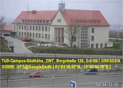
![[ X-border-EUregiaSDI-2008 ]](https://blogger.googleusercontent.com/img/b/R29vZ2xl/AVvXsEiJ3zx7X70dlLwH9P_RlWc-cdWieeBJckp6W2X0CpwUywg_VV2KcH2fjJsfVfEUsQqIAN_PHM4iiqU3fyVa8bHfE7QfT6iDl58ATQT03AEeh-tHa_AvKJMaoRgI-ewc8ia7YSKLc5y4xf-d/s692/2008_X.jpg)
![[ X-border-EUregiaSDI-2007 ]](https://blogger.googleusercontent.com/img/b/R29vZ2xl/AVvXsEjf3cP_Qbd2qyc1QqbLfoBq7nbvGkrbzccCm1oUZn7_heFokr_u4DxTzWD1tqf6YNYo3z-eImL92P19mK-HbTe_wr02KdX2nvaqca6bO2PMe0-Zk4lxul9Jq-txcOC4DUFP1J0VWL2IgeQ4/s692/2007_X.jpg)
![[ X-border-EUregiaSDI-2006 ]](https://blogger.googleusercontent.com/img/b/R29vZ2xl/AVvXsEidM6TPJAjqqqoVC1NREwEyzY2o0SMVxXvQ36d0SOAmArXkFB2ZS6Fm3IRd8QIVF7LRWGVGiLqcPeWqF2PUa5cr64umKWDIb1yOt4nB9m6Ta-6rjbnHiDhyphenhyphen4PqPbivB5WM75YLDcqFMTu7U/s692/2006_X.jpg)