[ GDI-SN ] - GeoINSPIRE'd Cross-border GI/GIS/GDI Interoperability

[ GDI-SN ] - GeoINSPIRE'd Cross-border GI/GIS/GDI Interoperability
[ GDI-SN ] Weblog Access MAP (c) by ClusterMaps ********** The ACCESS Map to [ GDI-SN.blogspot.de ] GeospatialSAXONY ( Status as per 08.11.2023 ) - TOTAL Views since 2003 > 248.408 ************************************************************************************************************************************

[ GI2016 ] Cross-border OpenGOV Data Interoperability [ GI2016 ]

[ GI2016 ] Cross-border OpenGOV Data Interoperability [ GI2016 ]
Open Government Diagram (c) by A.L.Coz & C. Lage ( Source via: [ https://upload.wikimedia.org/wikipedia/... ] *****************************************************************************

[ 1999 ] > IGN's Interoperability Vision >> [ GI2000 ]

[ 1999 ] > IGN's Interoperability Vision >> [ GI2000 ]
X-border OPENDATA: Sustainability & Interoperability of OpenGeoData & License Policy for Europe of Regions *******************************************************************************************

[ GI2016 ] +++ 4. Oktober 2016 in DRESDEN +++ *****************************************************

[ GI2016 ] +++ 4. Oktober 2016 in DRESDEN +++ *****************************************************
Dresden Photo Courtesy (c) 23.03.2014 by Hessbeck.Fotografix ******************************************************************************************* *******************************************************************************************

[ GI2016 ] +++ PROCEEDINGS +++ [ GI2016 ] ****************************************************

[ GI2016 ] +++ PROCEEDINGS +++ [ GI2016 ] ****************************************************
[ GI2016 ] - Workshop - PROCEEDINGS of Abstracts & Summaries - Dresden: 04.10.2016, 51 pp. [ GI2016 ] *******************************************************************************************

[ GI2000 ] ********** +++ < ARCHIV > +++ *********** [ GI2015 ] ***************************

[ GI2000 ] ********** +++ < ARCHIV > +++ *********** [ GI2015 ] ***************************
[ GI2000 ] Archiv of Proceedings Links are activated in GI2016 only!) [ GI2015 ] *******************************************************************************************

NNR & NN+ [ http://www.NATURNET.org ]

NNR & NN+ [ http://www.NATURNET.org ]
NATURNET+REDIME (NNR Coordinator: CCSS, Praha / Saxonian Partner: IGN, Dresden) ******************************************************************************************** This WEBLOG was initially designed & developed by 6th Framework Program SPECIFIC TARGETED RESEARCH PROJECT "NaturNet+Redime" - NNR - New Education and Decision Support Model for Active Behaviour in Sustainable Development Based on Innovative Web Services and Qualitative Reasoning, Project no. 004074, under priority SUSTDEV-2004-3.VIII.2.e +++ The NNR-Project has been followed up as FP7 "NATURNET+" ********************************************************************************************

[ IMPRESSUM (c) 2003 - 2024 ]

The WEBLOG Geospatial SAXONY # GeoINSPIRE'd NATURNET has been created December, 2006, in connection with activities of the EU-FP6-Project NaturNet+Redime (2005-2007) and its dissemination ROADMAP [WP-9] by IGN e.V. and other [ NNR ] Partner Organizations.

The WEBLOG informs especially about Interoperability, Sustainability and Usability issues in connection with the implementation of Directives 2003/98/EC ( PSI = Public Sector Information re-use ) and 2007/2/EC ( INSPIRE = INfrastructure for SPatial InfoRmation in Europe ) across borders in EUROPE of REGIONS.

WEBLOG Contents have been updated last: 07.11.2023
WEBLOG News Readings are to be updated: daily

Copyright (c) 2003-2024 by [ FH ], All rights reserved !
+++

[ WEBLOG Reading... updated daily! ]

Powered By Blogger

************************************************************************

WEBLOG Postings from "Geospatial SAXONY"

*************************************************
Showing posts with label Planning. Show all posts

Tuesday, 10 December 2019

REAL CORP 2020 (15.09.- 18.09.2020) !

Die REAL CORP 2020 wird von 15. bis 18. April 2020 in Aachen stattfinden.
POSTPONED in spite of CORONA-VIRUS !!!

REAL CORP 2020 is going to take place 
as from 15 to 18 September 2020 !!!

REAL CORP 2020
25. internationale Konferenz zu Stadtplanung und 
Regionalentwicklung in der Informationsgesellschaft
GeoMultimedia 2020

SHAPING URBAN CHANGE
LIVABLE CITY REGIONS FOR THE 21ST CENTURY
150 JAHRE RWTH AACHEN, 1. Aachener Städtebaukonferenz 

Weitere Informationen zu den Konferenzthemen 
finden Sie auf [ www.corp.at. ]

Tuesday, 13 August 2013

Thursday, 4 October 2012

Umbesetzungen im Tschechischen UMWELT-Ministerium !

Prag, 3.10.2012: Aus der gestrigen Pressemitteilung des Umweltministeriums (MZP/MoE) geht hervor, dass mehrere Leitungsfunktionen neu besetzt werden:
+++ neuer 1. Stv. Minister: Martin Frelich (Wirtschaft und Umweltpolitik) +++ neuer Stv. Minister: Tomas Geeky (Green Investment Programm) +++ neuer Direktor der Pressestelle: Matthias Vitík (Leiter Pressebüro und Sprecher des MoE) +++ neuer Direktor des CENIA: Vladimir Fanta (Umwelt-Landesamt, welches bisher für die Umsetzung von CZ-INSPIRE verantwortlich ist). +++ neuer Direktor des VUKOZ: Ivan Keks (Land- und Forst-Forschungsinstitut)
SOURCE: [ http://www.mzp.cz/cz/news_121003_personalni_zmeny ]
--
GI2012 - 12. Saxonian GIS-Forum /
PRESENTATIONS & PROCEEDINGS
[ http://gdi-sn.blogspot.de/2012/07/geozg-geodatenzugangsgesetz-has-been.html ]
--

IGN-Vorstand-Kontakte:
[ skype: fh-ign ]

[ mailto:vorstand@IGN-SN.de ]
[ tel # fax
: +49-351-403.2729 # 401.4260 ]
[ http://de.linkedin.com/pub/IGN-Vorstand/21/a66/64a ]
[ http://en-gb.facebook.com/people/IGN-Vorstand/100001648951366 ]
--

Friday, 17 August 2012

The power of social networks and social media (agriXchange suggestions)


 The power of social networks and social media
The future development of technology has to be based on a broader utilisation of social networks and social media.

New modelling methods
New modelling methods will become in future more important. Their importance will be not only in application like precision farming, but also in long time planning and decision making. It will require growing computing capacity to introduce methods including linear programming or theory of game
--
Open Source development
Open Source development can bring a lot of advantages not only for research, but also for commercial community. Open source can help to users (private and public) and for all IT sector. The future will give more opportunity for open solutions and also for smaller flexible companies, which will be able to adopt their behaviour and react on new situation. Other important issue is large international cooperation of small companies and not only inside of one country.
--
Management and accessibility of geospatial information
Management and accessibility of geospatial information as a key information source for any decision. Geospatial information includes not only digital maps, ortophotos or satellite imagery, but also location services and sensors. Importance of geospatial information will become more and more important and its amount will rapidly grow with new sensors technologies. Effective methods of management, accessibility and analysis will be important. Open access to data will be important.
--
Semantic models, multilingualism, vocabularies and automatic translation
Semantic models, multilingualism, vocabularies and automatic translation The understanding of terms was recognised by AgriExchange and also by SmartAgrifood, as one from big problems for implementing interoperability. So the focus on common understanding and vocabularies is very extremely important. Other large problem is multilingualism. Rural citizens in many countries usually are able to speak and write only by their mother language. Language is a large barriers, methods of automatic translation has to be developed.
--
Methods of knowledge management
Methods of knowledge management including aspects of interoperability. It is important to support the development of machine-readable legislation, guidelines and standards to integrate management information systems with policy tools. Major priorities for future knowledge systems will be the integration and orchestration among services based on semantic integration of collaborative activities, including semantic compatibility for information and services, as well as ontologies for collaboration.
--
Service oriented architecture for farming agriXchange recommendation
Service Oriented Architecture as a key element of architectures for future knowledge management systems. Service Oriented Architectures have to provide methods for systems development and integration where systems group functionality around business processes and package these as interoperable services.
--
Future Internet and Internet of things including sensor technology, cloud computing and machine to machine communication for agriculture and food
Future Internet architectures must reflect the needs and specificity of rural communities. It has to be resilient, trustworthy and energy-efficient and designed to support open access and increasing heterogeneity of end-points. Networks should sustain a large number of devices, many orders of magnitude higher than the current Internet, handle large irregular information flows and be compatible with ultra- high capacity, end-to-end connectivity.
  • What are your ideas?  
  • Source: [mailto: CCSS ]  &[agriXchange: LINKEDIN ]

Monday, 10 October 2011

[ NATURNET+GEOPORTAL-VIDEOS ]

The extented NNR new Geoportal project version "NATURNET+" has been finalized within the FP7/LLP programme (co-funded by EC Education & Culture DG, Lifelong Learning Programme "Leonardo da Vinci") .
  • [http://www.naturnet.org/simplecms/?menuID=1&action=article&presenter=Article]
The INNOVATION project NATURNET+Plus (NNP) started in October 2009 and has been closed by Final conference at September 27th, 2011 in Latvia.
  • [http://www.slideshare.net/NaturNetPlus/final-conference-poster]
The Geoportal components and functionality are presented now as 2 VIDEO-Presentations embedded on social SLIDESHARE network and can be watched either via NATURNET-Portal:
  • [http://www.naturnet.org/simplecms/?articleID=150&action=article&presenter=ArticleDetail]
or directly embedded links via IGN's weblog at "Geospatial SAXONY":
  • [http://gdi-sn.blogspot.com/] (Part 1 + 2).
embedded September 10th, 2011 / FH, IGN e.V.

Wednesday, 6 July 2011

[ Geospatial SAXONY -GI2011- Publications ]

[ GDI-SN.de ] Geospatial SAXONY - IGN e.V. ]
  • PROCEEDINGS & PRESENTATIONS
The GI2011-X-border-SDI/GDI-Symposium held in cross-border Euregio "Elbe#Labe":
  • 23.5.2011 in Bad Schandau (SAX) &
  • 24.5.2011 in Decin (CZE)
Its documents have been stored at SLIDESHARE and interlinked with "Social Networks" on FACEBOOK, LINKEDIN, TWITTER. The publications can be downloaded now via IGN's "Geospatial SAXONY" weblog portal site:
  • [ http://GDI-SN.blogspot.com ]
Dresden # Praha # Plzen, July 6th, 2011 IGN # CCSS # UniWB

Tuesday, 5 October 2010

[ GEOMATIK & RAUMPLANUNG ]

Geomatik & Raumplanungs - GIS - Konferenzen am 29./30. September in Plzen (CZ)! Eine zweitägige Konferenz fand am 29./30. September 2010 auf Schloß "Kozel" [http://www.zamek-kozel.cz] bei Plzen statt. Der erste Tag stand voll im Zeichen der 6. Wissenschaftlichen Konferenz "Student-GIS-Projekt", die insbesondere durch die ESRI-Niederlassung ARCDATA PRAHA sowie GEODIS BRNO u.a. Firmen gefördert wurde. Insgesamt 35 Vorträge demonstrierten ein hohes studentisches Niveau der ausgewählten Poster bzw. Vorträge von Studenten bzw. Aspiranten aus allen tschechischen Universitäten. Vorträge u.a. zur
  • Vektorisierung historischer Militärkarten,
  • Applikationsschnittstelle für geographische Daten von jüdischen Friedhöfen sowie
  • Modellierung des Oberflächenabflusses in ArcGIS Server
wurden durch die Jury, bestehend aus Hochschullehrern von 5 Universitäten, als Sieger gekürt. Auf Einladung des Geomatik-Fachbereiches an der Fakultät Mathematik der Westböhmischen Universität Plzen wurde am zweiten Konferenztag ein Keynote-Vortrag seitens IGN e.V. zum Konferenzschwerpunkt "Geomatik & Raumplanung" gehalten (Hoffmann, F.: Cross-border geomatics solutions for interoperable spatial planning applications based on X-GDI projects in Interreg3/4 (ETC/cil3) programs). Siehe unten: Proceedings of Abstracts: Statni zamek Kozel, 2010. ISBN 978-80-7399-113-5, pp. 11-14. Dabei wurde der Status grenzüberschreitender Geoportale an mehreren X-GDI-Beispielen aus den Euroregionen (X-GDI, GISOR, DACH+, CENTROPE etc.) diskutiert, und dieses Thema aus dem GI2010-Symposium-DRESDEN durch neuere Projektentwicklungen an Hand tschechischer (!) Originalquellen untersetzt. Am 30.9.2010 standen insgesamt drei Schwerpunkte im Mittelpunkt des zweiten Konferenztages:
  • Geomatik in der Raumplanung (u.a. EU-Projekte X-border-GDI, Plan4All, SDI-EDU, HUMBOLDT sowie CZ-Kataster, CZ-Reliefmodell, CZ-Migration)
  • Geomatik im Krisismanagement und Gesundheitswesen (CZ-Feuerwehr-Atlas, GeoDatenbanken, Visualisierung auf Krisis-Management-Karten) sowie
  • Geomatik im Denkmalschutz (u.a. Projekte CZ-RETRO, SOVAMM, 3D-GIS)
QUELLEN: [ http://www.cagi.cz/akcevypis.php?id=490 ] [ http://gis.zcu.cz/?page=geomatika-v-projektech ] [ http://www.arcdata.cz/akce/student-gis-projekt-2010 ] [ Geomatika v projektech 2010 / PDF ]

Thursday, 27 May 2010

[ GI2010 - 10. Sächsisches GIS-Forum ]

GI2010-Symposium-DRESDEN, 13./14./15. May 2010
  • "Europe of Regions - Sustainability of X-border & Inter-regional Collaboration"
  • The GI2010-Symposium-PROCEEDINGS of Abstracts, Keynotes, Summaries and Posters have been published !
The final public GI2010 edition of the PROCEEDINGS, as well as all PRESENTATIONS delivered on the occasion of "10. Sächsisches GIS-Forum" now have been opened on the for downloading... Acknowledgement is given explicitely to Chris Corbin (UK) for his excellent support and transposing of the symposium contents to the european PSI platform!
  • GI2010 marked the 10th Anniversary of "Sächsisches GIS-Forum", evolving from a series of GeoInfoStrategy seminars in GI2000-2002 via INSPIRE related EU-Project-Workshops in 2003-2005 and X-border oriented symposia in 2006-2010.
  • The GI2010-Symposium was focussing on X-border aspects of EU Directives ACCESS, PSI and INSPIRE. Keynoters, Authors of presentations and posters came from 12 countries, among them participants from 5 German 'Bundesländer". Presentations delivered were dealing with INNOVATIONS, X-border-PLAN*GIS*SDI, as well as NETWORK communities and projects.
At May 13th, 2010, the GI2010-Symposium was started with a pre-symposium personal meeting of the IGN Board together with part of active authors. +++ At first Day, May 14th, the Symposium was opened officially with several Keynotes about PSI, INSPIRE, X-border spatial planning, the challenges of INSPIRE ahead, as well as the integrated information management within the "Farm of the Future".
  • Presentations mostly as result from ongoing EU-FP7-Projects like BRISEIDE, GMES/INSPIRE implementation test, METASCHOOL, NATURNETplus, PLAN4ALL, SDI-EDU etc., as well as OpenAddresses and OpenStreetMap themes were provided from 9 countries: AT, BE, CH, CZ, DE, LV, PL, SK, UK. The Faculty of Architecture at TU Bratislava (SK) demonstrated selected posters from the MobEx-Poster-Exhibition (lead by Dr. FURDIK) with participants from AR, CZ, FR, HU, and SK. A special highlight were two TELE presentations transmitted from Muttenz (CH) and Ispra (IT) using an innovative Video-Lecturing tool developed for EU-Project "SDI-EDU" at University of RIGA (LV).
At second Day, May 15th, three Workshops were organized:
  • 1) the INSPIRE-Readiness-CHECK lectured by Roger LONGHORN (BE),
  • 2) the SDI strategies for local and regional governments demonstrated by BayernGIS GmbH and CAIGOS-Partner-NETWORK (Archikart AG, CAIGOS GmbH, GIS-Konzept GmbH, NTR-Software GmbH) and
  • 3) the Farm of the Future moderated by PROGIS GmbH from Villach (AT).
The GI2010-Symposium has been supported from EU programme of "Inter-regional collaboration" in Free State of Saxony and by several further supporting Organizations which provided related CDROM documents, flyers, reports, etc. Some of them should be named here explicitely:
  • Alta4, Archikart, Brandenburg Ministry of Infrastructure, BayernGIS, Business-Geomatics, CAIGOS-Partner-NETWORK, CzechCenter of Science & Society (CZ), Euro-Institut-Kehl, GeoSN, GIS-Konzept, Oberrheinkonferenz trinational (CH+DE+FR), PROGIS (AT), RegioGovernments of Liberec (CZ) and Alsace (FR).
Further detailed public sector information: see [ePSIplatform] !

Friday, 23 October 2009

[ Spatial planning and GIS workshop ]

14th annual workshop Spatial planning and GIS November 12th-13st, 2008, in Cascade Hotel Most (Czech Rep.)
  • CAGI, the Czech Association for Geoinformation, Section OS21 - GIT in Spatial Planning in cooperation with magistrate of city MOST kindly invite you to 14th geospatial workshop.
Workshop objectives and topics: - Present and evaluate contemporary GIS and SDI in Northern Bohemia, capabilities, solved topics, gaps and faults, needs, expectations - Provide a review on GIS/GIT news, innovations - Overview of European and national initiatives, funding possibilities, useful cooperations - Explain the relation between Spatial Planning (as the primary discipline) and GIS (as a service discipline), needs of technical arrangements for spatial planning process - Refresh and build new people-to-people professional relations based on direct communication of partners - To map CBC projects, discuss the ideas, proposals, to initiate new projects focused on multilingual geoinformation and SDI, modern GIT - Highlight and promote local GIS, good practices by municipal cities and workshop partners - Explain principles of low-cost GIS building, of Human Resources management in effective modern GIS (not only) for Spatial Planning - Up-to-date overview on Czech spatial planning in general legal environment, spatial planning instruments, especially „ÚAP“ in communities with extended power and regions - GIS as a tool for revitalisation in Northern Bohemia, solving the environmental consequencies to regional development - Czech transposition and implementation of INSPIRE European Directive - Sustainable development, SWOT analyses using GIS - Local planning documentation, urban plans, specifics - Presentation of good practice including detail questions and discussions using also the poster exhibition SOURCES:
  • [ http://cagi.cz/ ]
  • [ http://cagi.cz/upgis/index_en.htm ]
  • [ http://cagi.cz/upgis/most/program.doc ]
  • [ http://cagi.cz/upgis/most/en/index.php?akce=prihlaska ]
  • [ http://cagi.cz/upgis/most/en/index.php?akce=prihlaseni ]
  • [ http://cagi.cz/upgis/most/en/GISUP_Rahmenprogramm_Most.doc ]

[ GDI-SN-Weblog - ClustrMapsAccess ]

[ GI2013 ] - DRESDEN - 13. "Sächsisches GI/GIS/GDI-Forum" - SAXONY

[ GI2013 ] - DRESDEN - 13. "Sächsisches GI/GIS/GDI-Forum" - SAXONY
******************************************************************************************* DOWNLOAD the GI2013 - Forum - PROCEEDINGS @LINKEDIN & PRESENTATIONS @SLIDESHARE ! *******************************************************************************************

[ 26th International Technical Conference on Cartography - Dresden ]

*** DRESDEN - Saxony - GERMANY ***

*** DRESDEN - Saxony - GERMANY ***
***********************************************************************************

12. Sächsisches GIS-Forum - GI2012-OpenDataPolicies (DRESDEN:18./19.05.2012)

*****************************************************************************************

!!! [ GI2012-OpenDataPolicies-PROCEEDINGS ] !!!

!!! ( PRESENTATIONS of the GI2012-OpenData-Policies-FORUM - see below) !!!

*****************************************************************************************

[ Top-News (c) HeiseOnline ]

[ NATURNET_Application+Portal_VIDEOS ]

++++++++++++++++++++++++++++++++++++++++ ++++++++++++++++++++++++++++++++++++++++++++++ (c) by CCSS (Premysl Vochnout & NN+Team) ++++++ *****************************************************

[ GDI-SN-ARCHIV - Sächsisches GIS-Forum @IGN e.V. ]

[ Location of IGN e.V. @ GoogleMAP ]


IGN e.V. auf einer größeren Karte anzeigen

[ GI2015 ] +++ 15. "Sächsisches GI/GIS/GDI-Forum" in DRESDEN +++

"15. Saxon GI/GIS/SDI Forum" - GI2015 - Workshop (c) by IGN e.V.

"Open GeoData Management for Agriculture & Forestry"
Dresden, 15. September 2015
[
http://GDI-SN.blogspot.com ]
Contact: [
info@GDI-SN.de ]

ARCHIV: [ GI2014-PROGRAMME+PROCEEDINGS ] PDF, 7 MB

*******************************************************************************************

15.09.2015 - CoO & GI2015 - Workshops on Open GeoData Management
for Agriculture, Forestry and Development in Europe of Regions
UAV Technologies and Open Data for Precision Farming & Precision Forestry issues
COPERNICUS Program and SENTINEL Technologies for Agriculture and Forestry
INNOVATION and Technology transfer for International cross-border cooperation
MAPPING Technologies for Land use, Land cover and Rural Development
OPEN GEODATA Management for Environmental and Emergency

[ GI2015 - PROCEEDINGS - PDF, 3 MB ]
*******************************************************************************************

[ G-MAP ]

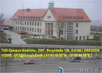
GPS [ 51°01’15.52″N ; 13°43’44.78″E ]
ISAF2015 @ TU-Dresden-AgriCAMPUS (ZINT)

[ Dresden City Atlas ]

Hotel Empfehlungen / Hotel recommendations / Pекомендации отеля

[ Booking.com Dresden ]
[ Hotels Dresden ]

*******************************************************************************************

[ ISAF2015 ] +++ 19. International Conference in DRESDEN +++

[ ISAF2015 ]
"19. International Conference ISAF2015" (c) organized by CCSS, Praha (CZ)
[ INFORMATION SYSTEMS for AGRICULTURE & FORESTRY ]
DRESDEN, 14. September - 15. September 2015

[ ISAF2015 - PRESENTATIONS ]

[ http://www.ClubOfOssiach.com/coo/visionandmission.html ]
Archive: [ http://ISAF2014.info/ ]
Contact: [ info@ISAF2015.info ]

[ ISAF2015 ] +++ 19. International Conference in DRESDEN +++

[ ISAF2015 ] +++ 19. International Conference in DRESDEN +++
Photo (c) by CCSS / ISAF2015 ******************************************************************************************* *******************************************************************************************

[ ISAF2015 ] +++ 19. International Conference in DRESDEN +++

[ ISAF2015 ] +++ 19. International Conference in DRESDEN +++
Photo (c) by CCSS / FOODIE / ISAF ******************************************************************************************* *******************************************************************************************

[ GI2011-X-border-SDI/GDI-Symposium ]

****************************************************
* 23.5.2011 Bad Schandau (SAX) # 24.5.2011 Decin (CZE)
****************************************************
EUROPE OF REGIONS -
"GeoINSPIRE’d
X-border-SDI/GDI for Digital Europe 2020"
Sustainability of Inter-regional Collaboration

****************************************************
* FINAL GI2011-X-Border-SDI/GDI PUBLICATIONS !
* [ PROCEEDINGS of GI2011-X-border-SDI ]
*** !!! PRESENTATIONS of GI2011-X-border-SDI
*** !!! stored on SLIDESHARE & are accessible via
*** !!! Social Networks instead of traditional GI20xx
*** !!! presentations of last years on ePSIplatform ...
* [ FACEBOOK | LINKEDIN | TWITTER ]
* [ ESDIN ] video-webcast (c) by A. CHRISTL, OSGeo (DE)
* [ PLAN4ALL ] snap-shot of T. MILDORF, UniWB (CZ)
* [ PLAN4ALL ] video-clip taken by (c) R.J. LACH (PL)
*** !!! inter-linked GI2011 presentations:

GI2011+proceedings v5 final

AEBR Ramirez ppt_gi2011
Alberts+Team ppt gi2011
Bendel ppt gi2011
Berzina ppt gi2011
Berzins+Team ppt gi2011
Blachowski+Team ppt gi2011
Cepicky+Charvat ppt gi2011 hslayers
Cepicky+Charvat ppt gi2011 pywps
Cerba+Team ppt gi2011
Charvat+Vohnout ppt gi2011 enviro
Charvat+Team ppt gi2011 habitats
Charvat ppt gi2011 spidernet
Christl ppt gi2011 esdin+video
Faugnerova+Charvat ppt gi2011
GI2011 poster cz_ioer
GI2011 poster de_ioer
GI2011 poster sk stuba border
GI2011 poster sk stuba danube
Hoffmann ppt gi2011
Janecka ppt gi2011
Kafka+Charvat ppt gi2011
Kliment+Oggioni ppt gi2011
Kliment ppt gi2011
Knippschild ppt gi2011
Lach ppt gi2011

Malczewski+Team ppt gi2011
Mayer ppt gi2011
Mildorf+Team ppt gi2011
Mirbach+Lang ppt gi2011
Roehnert+Team ppt gi2011
Schrenk+Team ppt gi2011
Stern ppt gi2011
Thevenet ppt gi2011
Vohnout ppt gi2011 geoportal4everybody

****************************************************
GI2011-X-border-SDI/GDI-Symposium with inter-regional participation from European Border Regions (EBR) !
11. Sächsisches GIS-Forum, Bad Schandau (SAX), 23.05.2011
& 1. Bohemia # Saxonia GIS-Forum, Decin (CZE), 24.05.2011
+++ 33 Presentations had been selected from:
+++ AT, CZ, DE, ES, FR, IT, LV, OSGeo, PL, SK, ... !
****************************************************
All logistic, social, cultural and touristic weblinks have been re-located into weblog message of today, 28.5.2011, and stored into IGN's weblog postings ARCHIVE !
****************************************************

[ GI2010 - 10. Sächsisches GIS-Forum ]

************************************************
The PRESENTATIONS of the Anniversary
10th International "Sächsisches GIS-Forum"
[
GI2010-Symposium-Poster-DRESDEN ]

"Sustainability of X-border & Inter-regional Collaboration"

[ GI2010_Proceedings_FINAL_WEB-Version ]
have been published @ European PSI platform !
+ [ HERLITZIUS - Welcome@AST ] DE-TU-Dresden

************************************************
KEYNOTE speakers:
+ [ HOFFMANN ] DE-Dresden-IGN e.V.
+ [ CORBIN ]
UK-Brighton-ePSIplatform
+ [ BELOF ]
PL-Wroclaw-WBU
+ [ CHARVAT ]
CZ-Praha-CCSS
+ [ LONGHORN ]
BE-Brussel-IDRA-Ltd.
+ [ MAYER ]
AT-Villach-PROGIS-GmbH
************************************************
13. Mai 2010 / GI2010-Pre-Symposium-Authors-Meeting
------
14. Mai 2010 / 08:30 - 18:30 / GI2010-SYMPOSIUM
Sessions: GI2010, INNOVATIONS, X-border-GDI, NETWORKS
+ [ Mayer-Leixner ] NTR-Software GmbH, Heidesheim
+ [ BLACHOWSLI et al. ] PL-Wroclaw-WBU
+ [ VOHNOUT ] CZ-Praha-CCSS
+ [ FENCIK ] SK-Bratislava-SAGI&STUBA
+ [ BAUMANN-1 ] BayernGIS GmbH, Kolbermoor GmbH
+ [ MECHA et al. ] PL-Katowice-GISPOL/GEOBID GmbH
+ [ MILDORF et al. ] CZ-Plzen-WBUNI
+ [ JANECKA et al. ] CZ-Plzen-WBUNI
+ [ KUBICEK et al. ] CZ-Brno-MUNI
+ [ BERZINS ] LV-Riga-UNI
+ [ STARK ] CH-Muttenz-FHNW (TELE-Lecture)
+ [ LINGNER ] OSM-Consultant-Potsdam
+ [ KOSKOVA et al. ] CZ-Liberec-KULK
+ [ SCHAFFERT ] IKGIS/TUDA, Darmstadt
+ [ MODRY ] CZ-Liberec-KULK
+ [ KLOSA et al. ] OSM-Dresden
+ [ BAUMANN-2 ] BayernGIS GmbH, Kolbermoor
+ [ POPIOLEK ] LiveMap GmbH, Berlin
+ [ KLIMENT ] SK-Bratislava-STUBA (TELE-Lecture)
Workshops: Introductions / Kurzeinführungen
+ [ BAUMANN-WS ] BayernGIS GmbH, Kolbermoor
CAIGOS-Partner-NETZWERK:
++ [ MAYER-LEIXNER ] NTR-Software GmbH, Heidesheim
+++ [ NACHTIGALL ] ARCHIKART-Software AG, Lauchhammer
++++ [ LEHRACH ] GIS-Konzept, Leipzig & CAIGOS GmbH, Kirkl
------
15. Mai 2010 / 08:30 - 11:30 / GI2010-Post-Workshops
WS 1 - INSPIRE "Readiness-Check-List"
Vorbereitungstest für Kommunen & Landkreise
+ [ LONGHORN-1.1 ] - BE - Brussel, IDRA Ltd.
++ [ LONGHORN-1.2 ]
+++ [ LONGHORN-1.3 ]
------
WS 2 Kommunal & Regional GIS/GDI
Strategien für Kommunen & Landkreise
+ [ BAUMANN ] -
BayernGIS GmbH, Kolbermoor
& CAIGOS-Partner-NETZWERK:
++ [ MAYER-LEIXNER ] - NTR-Software GmbH, Heidesheim
+++ [ NACHTIGALL ] - Archikart Software AG, Lauchhammer
++++ [ LEHRACH ] - GIS-Konzept GmbH, Leipzig
------
WS3 Agrarbetrieb der Zukunft - Farm of the Future -
The Vision for Tomorrow
+ [ CHARVAT ] - CZ - Praha, CCSS NGO
++ [ MAYER ] - AT - Villach, PROGIS GmbH
************************************************
POSTER-Exhibition by STUBA (SK)
+ [ Selected MobEx Posters.jpg ]
MobEX project lead by Dr. J. FURDIK,
Slovak Technical University Bratislava (FA-CADLAB),
has been funded by International Visegrad Fund
+ [ MobEX-Gallery-PROJECT ]
+ [ SK01 ] + [ SK02 ] + [ SK03 ]
+ [ CZ04 ] + [ CZ07 ]
+ [ HU04 ] + [ HU08 ]
+ [ PL01 ] + [ PL02 ]
For Poster abstracts see PROCEEDINGS !
************************************************
************************************************


[ GI2009 - 9. Sächsisches GIS-Forum ]

GI2009-Symposium-DRESDEN
with international participation from
AT, BE, CN, CZ, DE.bb.nrw.sn, HU, PL, ... SK, UK

Status as per: 09.05.2009 !
-------
[ GI2009 - FINALPROGRAMM ]
WEBLOG-Version-20090515, ca. 250 KB
-------------------------------------------------------------------------------
Supporting organizations: "1spatial", "BusinessGeomatics", BOWGIS @FAA, CAGI, CCSS, ESPON @EC-Unit-Luxembourg, "interface:projects" GmbH Dresden, "PROGIS" Software GmbH Villach (AT), RegioGOV-LDD, RegioGOV-KULK (CZ), "NaturNet", AST@TUD, GeoNRW, GeoSN, ...
-------------------------------------------------------------------------------
( GI2009 has been last updated: 07.06.2009 / 15:00 )
-------------------------------------------------------------------------------
PRESS announcements by contributing GI Companies...
AT: [ PROGIS NEWS ]
UK: [ 1spatial keynotes GI2009 ]
USA: [ GIScafe NEWS ]
-------------------------------------------------------------------------------
GI2009-Symposium-GPS: [ 51°01'15.52"N, 13°43'44,78"E ]
-------------------------------------------------------------------------------
OFFENER AUFRUF <> OPEN CFP
[ GI2009 - OPEN CALL for PRESENTATIONS ]
ABSTRACTS for Papers, Posters, PC-Demos, Workshops
--------------------------------------------------------------------
TERMINE / SCHEDULES:
Europa-Woche/Week: 02.-10. Mai 2009
Europa-KMU/SME-Woche/Week: 06.-14. Mai 2009
ORT/Location: DRESDEN
------------------------------------------------------------------------------
"Konrad-ZUSE-Haus" (2.-10.Mai: Europawoche 2009 & 6.-14.Mai: EU-SME-Week) and 14./15. Mai: "Technical University" - "AgrarCAMPUS" - Bergstrasse 120, Hörsaal ZIN120 (GI2009-Symposium) und Raum ZIN025 (Workshops )
--------------------------------------------------------------------------------
TITEL: EUROPA der REGIONEN im "Europäischen Jahr der Kreativität und Innovation" - Nachhaltigkeit der interregionalen Zusammenarbeit - ...
(The European Year of Creativity & Innovation - Sustainability of inter-regional Collaboration - ...)

[ Goals of the European Year ] of Creativity and Innovation: ... the objective to raise awareness of importance of creativity and innovation for personal, social and economic regional and cross-border development,
- to disseminate good practices...
- to stimulate education and research... and
- to promote policy debate and development...
The GI2009 in this European Year
addressed a wide spectrum of related themes such as: EU projects, education and life-long-learning, ICT, PSI, SDI, X-GDI for sustainable development process, regional and local development strategies based on creative and innovative X-INSPIRE'd applications, re-use of Public Sector Information and openness of GEO-ENVIRO-SPATIO infrastructures for rural agriculture, forestry and water management in EUROPE of REGIONS.
[ EJKI2009 # EC Presseinfo DE # EC Press EN ]
--------------------------------------------------------------------------------

[ EUNAVTEC & POSITION 2008 ]

[ The EU-FP6-NNR-Project-TEAM ]

[ The EU-FP6-NNR-Project-TEAM ]
2003-2007: The NNR Team and Participants at "Krimulda/Birini" Workshop ( LV )

[ The NN-Team @ FRANCAVILLA Workshop ]

[ The NN-Team @ FRANCAVILLA Workshop ]
24.10.2007: Final Workshop at Francavilla (Sicilia, IT)

[ NNR-X-border-PRESENTATIONS ]

  • 30. November 2007: [ NNR-QRM-Garp3-VIDEO ] QT.mov, 22MB. This is a Quicktime-Video-Format from the REDIME part of NNR-Project demonstrating the modelling of expert knowledge on sustainability and simulating the behaviour of river ecosystems in different regions in Brazil and Europe. The Garp3 application has been developed by the REDIME project team managed by University of Amsterdam and demonstrated at GI2007-Symposium, the 7th Saxonian GIS-Forum event at 5th October 2007 in "NationalParkZentrum" Bad Schandau / Sachsen.
  • 5. Oktober 2007: [ NNR-Tools at 7. Sächsisches GIS-Forum ] Bad Schandau, National-Park-Zentrum (Final NNR-X-IGN program).
  • 11. September 2007: [ NATURNET-Content-NAVIGATOR ] This NCN-Tool has an Expert Knowledge Metainfo Database built-in working together with Open freeware search engine CDS-2, v2.1.1 (Actually, version 2.3.18 has been released in April 2008) - The NCN resources have been composed by IGN e.V. and presented at "7. Sächsisches GIS-Forum" - a dissemination & crossborder GI2007-Symposium, as FINAL NNR-X-IGN event, organized by IGN e.V.
  • 22. Juni 2007 [ IGN-Presentation at BITOV2007 (CZ) ] - PPT (22 MB) - Sorry, the official URL is not yet available at CZ-CAGI website. Therefore, it has been included as lecture module into NATURNET-eLearning-Platform MOODLE.
  • 21. Juni 2007: [ BITOV2007 (CZ) ] Spatial Planning & GIS
  • [ IGN-Presentation at MIKULOV2007 (CZ) ] - PPT (18 MB) - Sorry, the official URL is not yet available at CZ-CAGI website. Therefore, it has been included as lecture module into NATURNET-eLearning-System MOODLE.
  • 29. Mai 2007: [ MIKULOV2007 (CZ) ] 1st CZ National GIS-Congress
  • 10. Mai 2007: [ X-border-GI2007-Symposium ] Presentation of NATURNET intermediate results at 6. Sächsische GIS-Forum, Dresden 10./11.05.2007, published at EU-PSI-Navigator project website for Public Sector Information.

[ EU-FP6-Project-NNR ( NaturNet+Redime ) ]

  • IGN NATURNET-Symposium-REGISTRATION (DOC, 270 KB) - NationalParkZentrum, Bad Schandau, 5th October 2007 (10-17): Please, return this form back by EMAIL until October 1st, 2007 (Anmeldung bis zum 1. Oktober per Email ! )
  • IGN NATURNET-Symposium-REGISTRATION (PDF, 44 KB) - NationalParkZentrum, Bad Schandau, 5th October 2007 (10-17): Please, return this form back by EMAIL until October 1st, 2007 (Anmeldung bis zum 1. Oktober per Email ! )
  • IGN NATURNET Programm FINAL Dissemination SYMPOSIUM NationalParkZentrum, Bad Schandau, 5th October 2007 (10-17) Invitation & Programm ### Einladung & Programm (PDF, 63 KB) KONTAKT: Tel. +49-351-403.2729 ##### !!!! #######
  • 2007: CZ-Portal-NATURNET-Server (Updated status: 20.12.2008)
  • 2006: EU-X-GeoPortal-NNR (Limited Guest access is possible)
  • 2005: NNR-Intern (FTP) (For NNR Partners only)
  • 2005: NNR-Project (Open access)
  • 2005: NNR WMS-KickOff-SERVER (since 2008 a new updated: CZ-HSRS-MapServer) was introduced.
  • 2004: The two Projects "NaturNet+Redime" (NNR) had to be joined together... and the proposal had been re-written.
  • 2003: EU-FP6-STREP Project proposal "NaturNet" was delivered to the European Commission.

[ NNR-GeoINSPIRE'd-PORTAL-Tools ]

[ GDI-SN.blogspot.com STATISTICS Start date: 01.01.2018 ]

[ Weblog counter private LOGIN ]

[ FEEDJIT Live Traffic FEED ]

[ RMAP-Globe-ACCESS ]